MyTopo
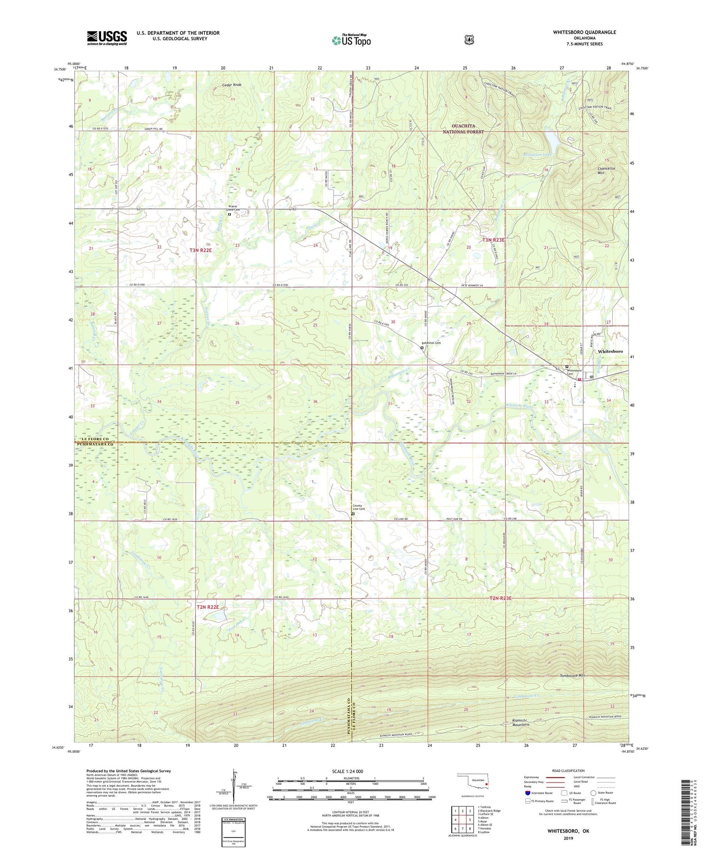
Whitesboro Oklahoma US Topo Map
Couldn't load pickup availability
Also explore the Whitesboro Forest Service Topo of this same quad for updated USFS data
2022 topographic map quadrangle Whitesboro in the state of Oklahoma. Scale: 1:24000. Based on the newly updated USGS 7.5' US Topo map series, this map is in the following counties: Le Flore, Pushmataha. The map contains contour data, water features, and other items you are used to seeing on USGS maps, but also has updated roads and other features. This is the next generation of topographic maps. Printed on high-quality waterproof paper with UV fade-resistant inks.
Quads adjacent to this one:
West: Albion
Northwest: Talihina
North: Blackjack Ridge
Northeast: Leflore SE
East: Muse
Southeast: Ludlow
South: Honobia
Southwest: Albion SE
This map covers the same area as the classic USGS quad with code o34094f8.
Contains the following named places: Birney Creek, Bohannon Cemetery, Bohannon Creek, Bohannon Lake, Bohannon Lake Dam, Buzzard Creek, Camp Tom Hale, Cedar Knob, Chancellor Mountain, Christs Church, Council House, County Line Cemetery, Deadman Creek, Frazier Creek, Post Oak Creek, Prairie Grove Cemetery, Prairie Grove Church, Tombstone Creek, Tombstone Mountain, Township of Talihina, Wadesville Church, Whitesboro, Whitesboro Cemetery, Whitesboro Census Designated Place, Whitesboro Elementary School, Whitesboro Fire Department, Whitesboro High School, Whitesboro Post Office, Woods Creek, ZIP Code: 74571