MyTopo
Okarche Oklahoma US Topo Map
Couldn't load pickup availability
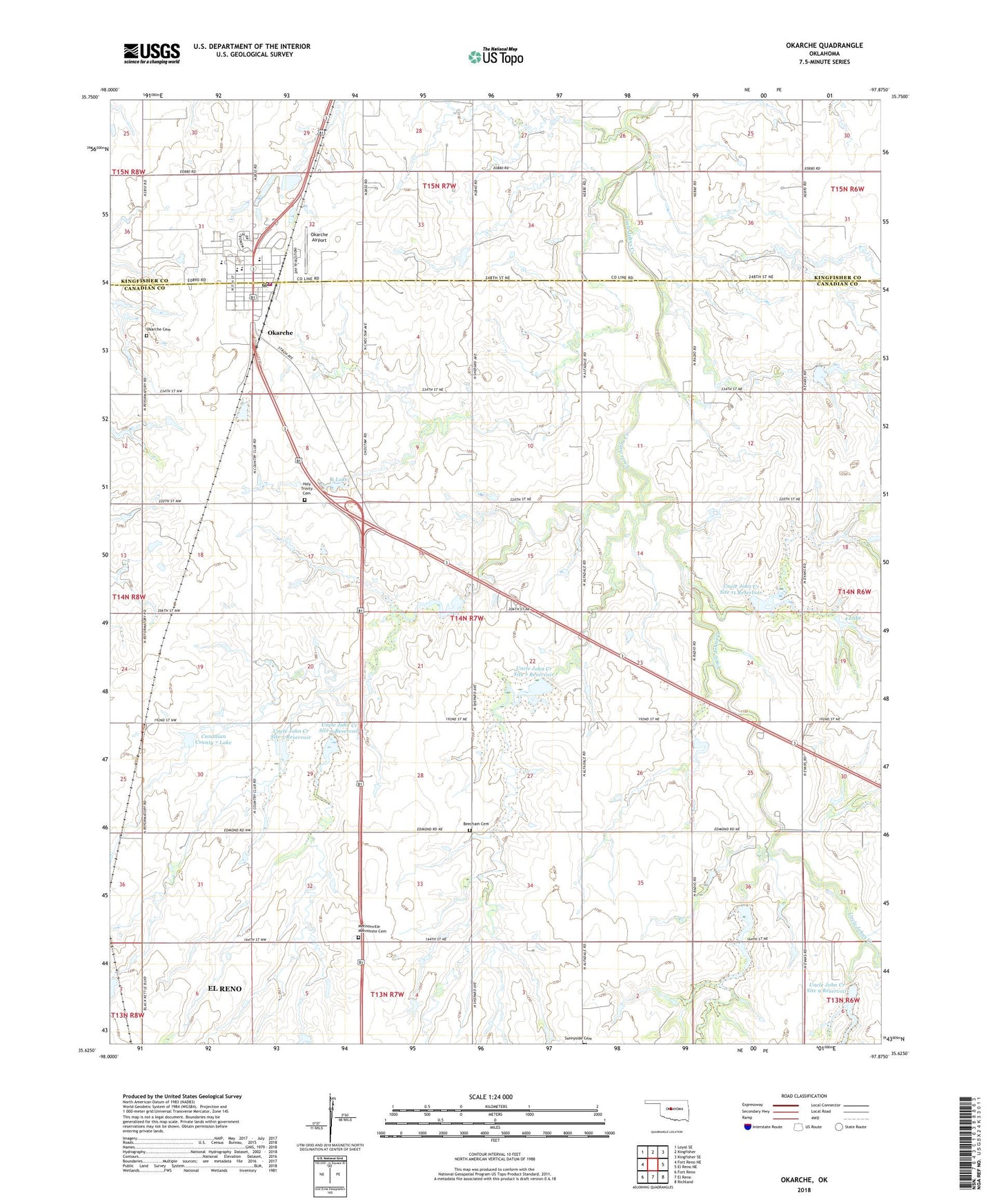
2018 topographic map quadrangle Okarche in the state of Oklahoma. Scale: 1:24000. Based on the newly updated USGS 7.5' US Topo map series, this map is in the following counties: Canadian, Kingfisher. The map contains contour data, water features, and other items you are used to seeing on USGS maps, but also has updated roads and other features. This is the next generation of topographic maps. Printed on high-quality waterproof paper with UV fade-resistant inks.
Quads adjacent to this one:
West: Fort Reno NE
Northwest: Loyal SE
North: Kingfisher
Northeast: Kingfisher SE
East: El Reno NE
Southeast: Richland
South: El Reno
Southwest: Fort Reno
Contains the following named places: Beecham Cemetery, Chandler Armory Heliport, Cheyenne and Arapahoe District 2, Holy Trinity Catholic School, Holy Trinity Cemetery, Mennonville Mennonite Cemetery, Okarche, Okarche Airport, Okarche Cemetery, Okarche Elementary School, Okarche Fire Department, Okarche High School, Okarche Junior High School, Okarche Police Department, Okarche Post Office, Oknoname 017004 Dam, Oknoname 017006 Dam, Oknoname 017007 Dam, Oknoname 4 Lake, Oknoname 6 Lake, Oknoname Canadian County 7 Lake, Saint John Lutheran School, Town of Okarche, Township of Rock Island, Uncle John Creek Site 11 Dam, Uncle John Creek Site 11 Reservoir, Uncle John Creek Site 4 Dam, Uncle John Creek Site 4 Reservoir, Uncle John Creek Site 5 Dam, Uncle John Creek Site 5 Reservoir, Uncle John Creek Site 6 Dam, Uncle John Creek Site 6 Reservoir, Uncle John Creek Site 7 Dam, Uncle John Creek Site 7 Reservoir, Uncle John Creek Site 8 Dam, Uncle John Creek Site 8 Reservoir, Uncle John Creek Site 9 Dam, Uncle John Creek Site 9 Reservoir, ZIP Code: 73762