MyTopo
Fort Reno Oklahoma US Topo Map
Couldn't load pickup availability
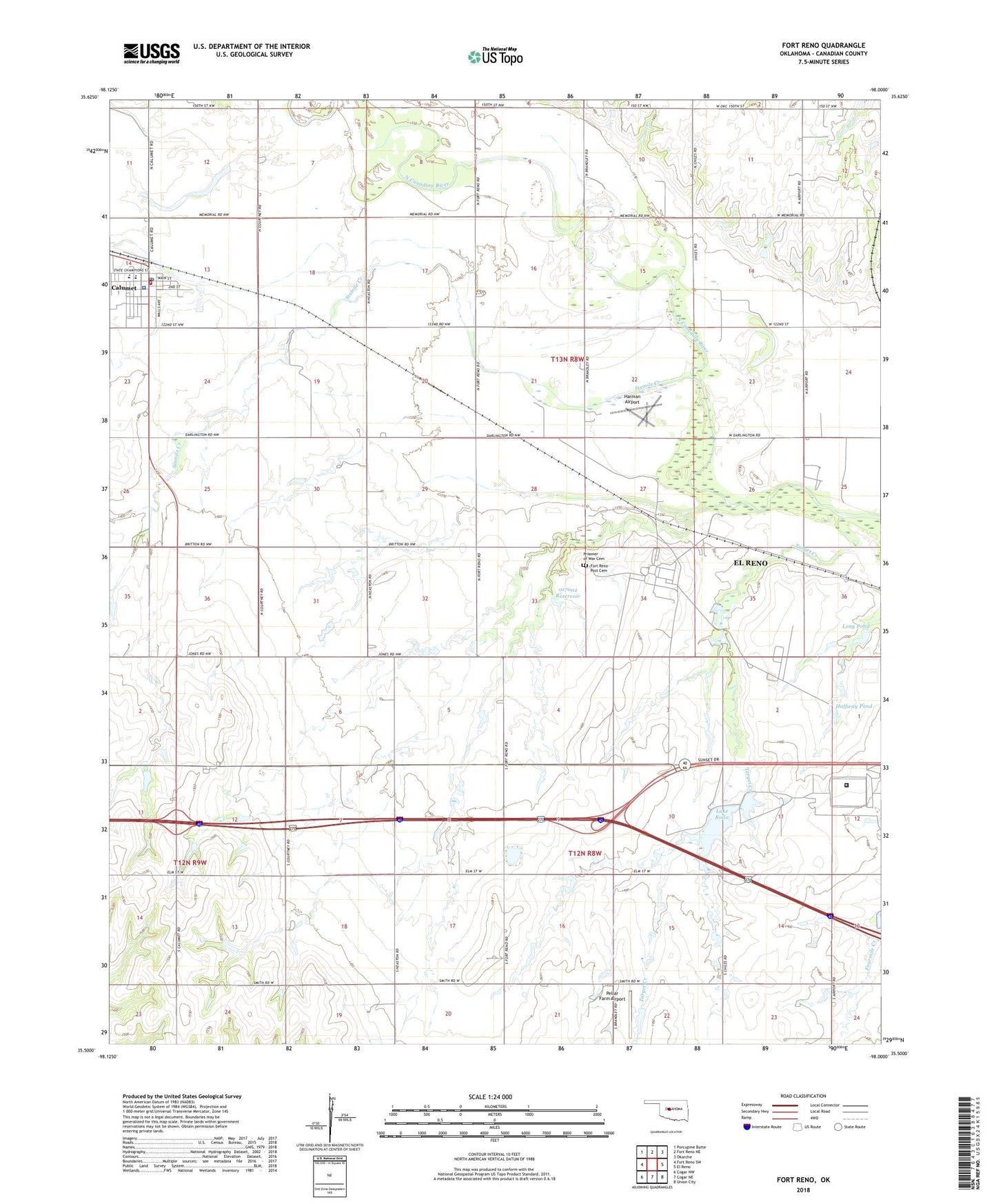
2022 topographic map quadrangle Fort Reno in the state of Oklahoma. Scale: 1:24000. Based on the newly updated USGS 7.5' US Topo map series, this map is in the following counties: Canadian. The map contains contour data, water features, and other items you are used to seeing on USGS maps, but also has updated roads and other features. This is the next generation of topographic maps. Printed on high-quality waterproof paper with UV fade-resistant inks.
Quads adjacent to this one:
West: Fort Reno SW
Northwest: Porcupine Butte
North: Fort Reno NE
Northeast: Okarche
East: El Reno
Southeast: Union City
South: Cogar NE
Southwest: Cogar NW
This map covers the same area as the classic USGS quad with code o35098e1.
Contains the following named places: Calumet, Calumet Elementary School, Calumet High School, Calumet Junior High School, Calumet Police Department, Calumet Post Office, Calumet Volunteer Fire Department, Cheyenne and Arapaho Agency, Darlington State Game Bird Hatchery, El Reno Federal Reformatory, Federal Correctional Institution El Reno, Fort Reno Post Cemetery, Halfway Pond, Harman Airport, Lake Rolla, Long Pond, Oknoname 017002 Dam, Oknoname 017002 Reservoir, Pellar Farm Airport, Prisoner of War Cemetery, Sixmile Creek, Southwestern Livestock and Forage Research Station, Target Creek, Town of Calumet, Township of Darlington