MyTopo
Okemah SE Oklahoma US Topo Map
Couldn't load pickup availability
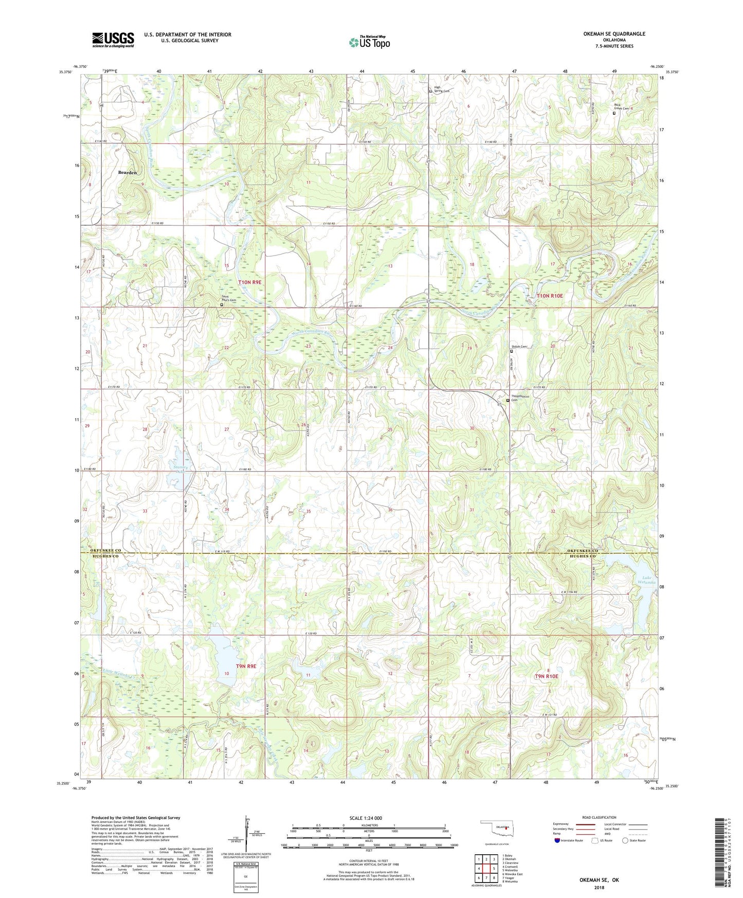
2018 topographic map quadrangle Okemah SE in the state of Oklahoma. Scale: 1:24000. Based on the newly updated USGS 7.5' US Topo map series, this map is in the following counties: Okfuskee, Hughes. The map contains contour data, water features, and other items you are used to seeing on USGS maps, but also has updated roads and other features. This is the next generation of topographic maps. Printed on high-quality waterproof paper with UV fade-resistant inks.
Quads adjacent to this one:
West: Cromwell
Northwest: Boley
North: Okemah
Northeast: Clearview
East: Weleetka
Southeast: Wetumka
South: Yeager
Southwest: Wewoka East
Contains the following named places: Bearden Oil and Gas Field, East Bearden Oil Field, High Spring Cemetery, High Spring Church, Lake Wetumka, Little Wewoka Creek Site 10 Dam, Little Wewoka Creek Site 10 Reservoir, Little Wewoka Creek Site 7 Dam, Little Wewoka Creek Site 7 Reservoir, Little Wewoka Creek Site 8 Dam, Little Wewoka Creek Site 8 Reservoir, Little Wewoka Creek Site 9 Dam, Little Wewoka Creek Site 9 Reservoir, Lone Star School, Oknoname 063013 Dam, Oknoname 063013 Reservoir, Papoose Oil Field, Phillips Chapel, Rock Creek Cemetery, Saint Paul's Cemetery, Scott Gas Field, Shiloh Cemetery, Stanley Lake, Stanley Lake Dam, Thlopthlocco Cemetery, Thlopthlocco Church, Township of Bearden, Wetumka Oil Field