MyTopo
Marietta East Oklahoma US Topo Map
Couldn't load pickup availability
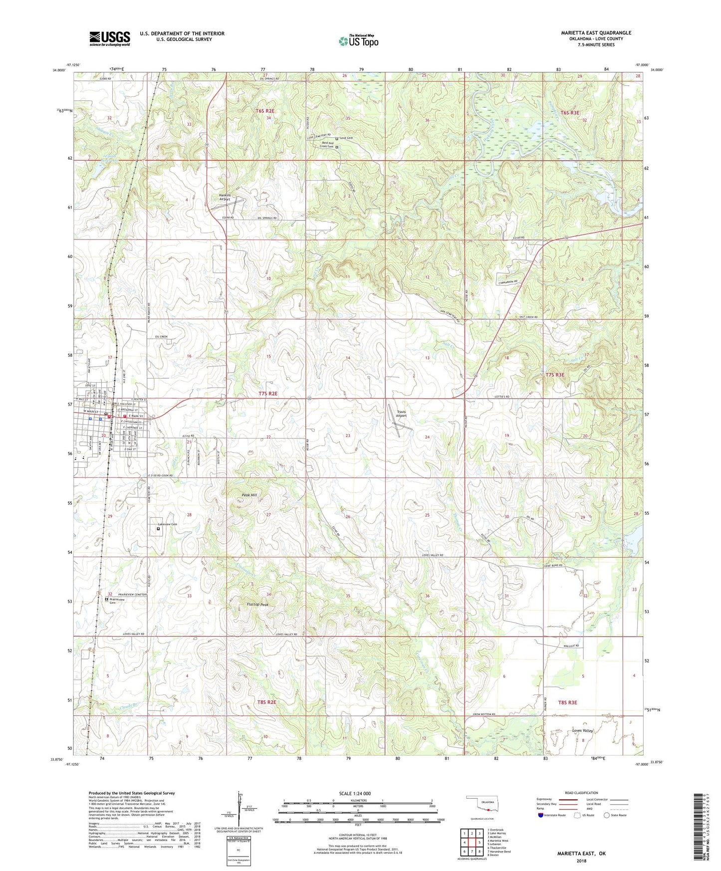
2022 topographic map quadrangle Marietta East in the state of Oklahoma. Scale: 1:24000. Based on the newly updated USGS 7.5' US Topo map series, this map is in the following counties: Love. The map contains contour data, water features, and other items you are used to seeing on USGS maps, but also has updated roads and other features. This is the next generation of topographic maps. Printed on high-quality waterproof paper with UV fade-resistant inks.
Quads adjacent to this one:
West: Marietta West
Northwest: Overbrook
North: Lake Murray
Northeast: McMillan
East: Lebanon
Southeast: Dexter
South: Horseshoe Bend
Southwest: Thackerville
This map covers the same area as the classic USGS quad with code o33097h1.
Contains the following named places: Church of Christ, City of Marietta, East Love Division, Eastside Baptist Church, First Baptist Church - Marietta, First Christian Church, Flattop Peak, Hankins Airport, Lakeview Cemetery, Love Cemetery, Love County Jail, Love County Sheriff's Office, Loves Valley, Marietta, Marietta Elementary School, Marietta Fire Department Station 1, Marietta Fire Department Station 2, Marietta Middle School, Marietta Police Department, Marietta Post Office, Mount Zion Baptist Church, Oil Creek, Oknoname 085002 Dam, Oknoname 085002 Reservoir, Oknoname 123018 Dam, Oknoname 123018 Reservoir, Peak Hill, Prairieview Cemetery, Pumpkin Creek, Reid and Cross Cemetery, Shiggin Creek, Thomas Creek, Travis Airport, United Methodist Church, ZIP Code: 73448