MyTopo
Pearson Oklahoma US Topo Map
Couldn't load pickup availability
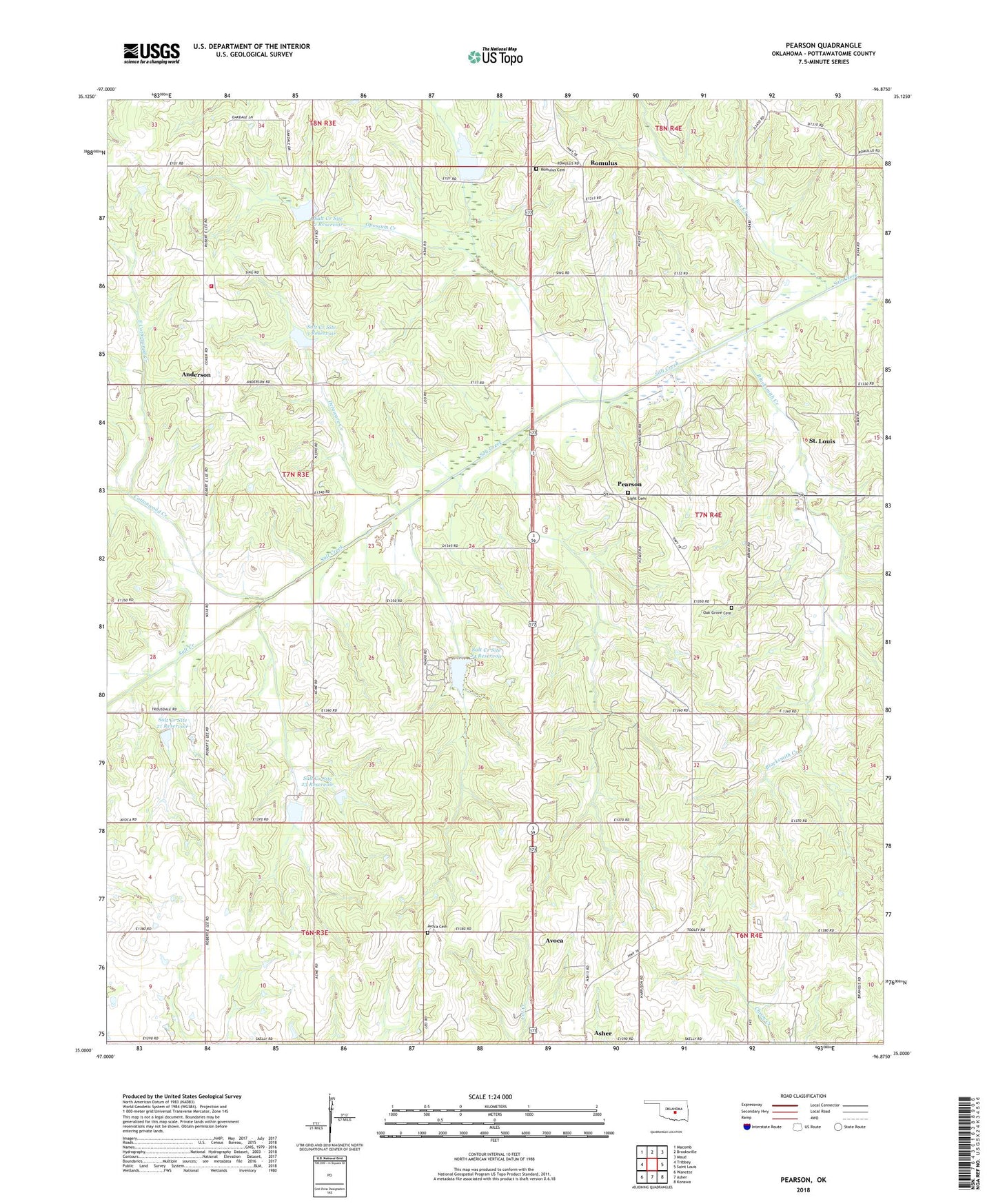
2018 topographic map quadrangle Pearson in the state of Oklahoma. Scale: 1:24000. Based on the newly updated USGS 7.5' US Topo map series, this map is in the following counties: Pottawatomie. The map contains contour data, water features, and other items you are used to seeing on USGS maps, but also has updated roads and other features. This is the next generation of topographic maps. Printed on high-quality waterproof paper with UV fade-resistant inks.
Quads adjacent to this one:
West: Tribbey
Northwest: Macomb
North: Brooksville
Northeast: Maud
East: Saint Louis
Southeast: Konawa
South: Asher
Southwest: Wanette
Contains the following named places: Anderson, Anderson School, Avoca, Avoca Cemetery, Blacksmith Creek, Box Creek, Cloverdale School, Cottonwood Creek, Delaware Creek, East Cottonwood Creek, Light Cemetery, Louis Oil Field, Macomb Fire Department Station 2, Oak Grove Cemetery, Oak Grove Church, Opossum Creek, Pearson, Romulus, Romulus Cemetery, Salt Creek Site 1 Dam, Salt Creek Site 1 Reservoir, Salt Creek Site 2 Dam, Salt Creek Site 2 Reservoir, Salt Creek Site 21 Dam, Salt Creek Site 21 Reservoir, Salt Creek Site 22 Dam, Salt Creek Site 22 Reservoir, Salt Creek Site 23 Dam, Salt Creek Site 23 Reservoir, Salt Creek Site 24 Dam, Salt Creek Site 24 Reservoir, Salt Creek Site 3 Dam, Salt Creek Site 3 Reservoir, Wanette-Asher Division, ZIP Code: 74826