MyTopo
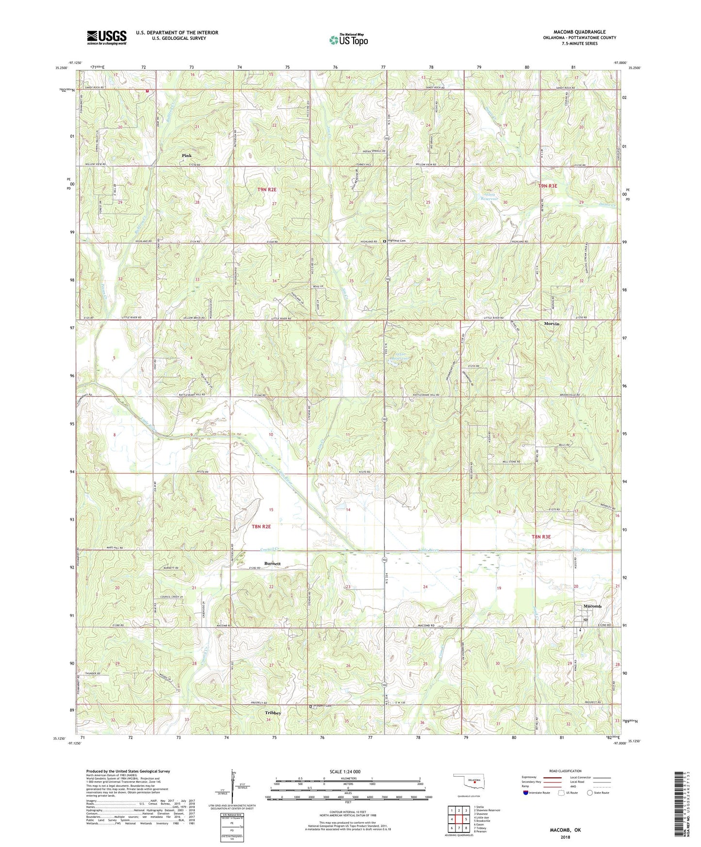
Macomb Oklahoma US Topo Map
Couldn't load pickup availability
2022 topographic map quadrangle Macomb in the state of Oklahoma. Scale: 1:24000. Based on the newly updated USGS 7.5' US Topo map series, this map is in the following counties: Pottawatomie. The map contains contour data, water features, and other items you are used to seeing on USGS maps, but also has updated roads and other features. This is the next generation of topographic maps. Printed on high-quality waterproof paper with UV fade-resistant inks.
Quads adjacent to this one:
West: Little Axe
Northwest: Stella
North: Shawnee Reservoir
Northeast: Shawnee
East: Brooksville
Southeast: Pearson
South: Tribbey
Southwest: Eason
This map covers the same area as the classic USGS quad with code o35097b1.
Contains the following named places: Bullfrog Creek, Burnett, Burnett Oil Field, Citizen Potawatomi Nation-Absentee Shawnee Oklahoma Tribal Statistical Area, Coon Creek, Council Creek, Highland Cemetery, Highland School, Jim Creek, Macomb, Macomb Elementary School, Macomb Fire Department Station 1, Macomb High School, Macomb Post Office, Morvin, Morvin Oil Field, O K Church, Oknoname 087006 Dam, Oknoname 087006 Reservoir, Oknoname 12509 Dam, Oknoname 12509 Reservoir, Oknoname 12510 Dam, Oknoname 12510 Reservoir, Pecan Creek, Pink Fire Department, Prospect Cemetery, Rocky Dam, Rocky Reservoir, Sand Creek, South Macomb Oil Field, Town of Macomb, Town of Pink, Township of Burnett, West Morvin Oil Field, Willow View School