MyTopo
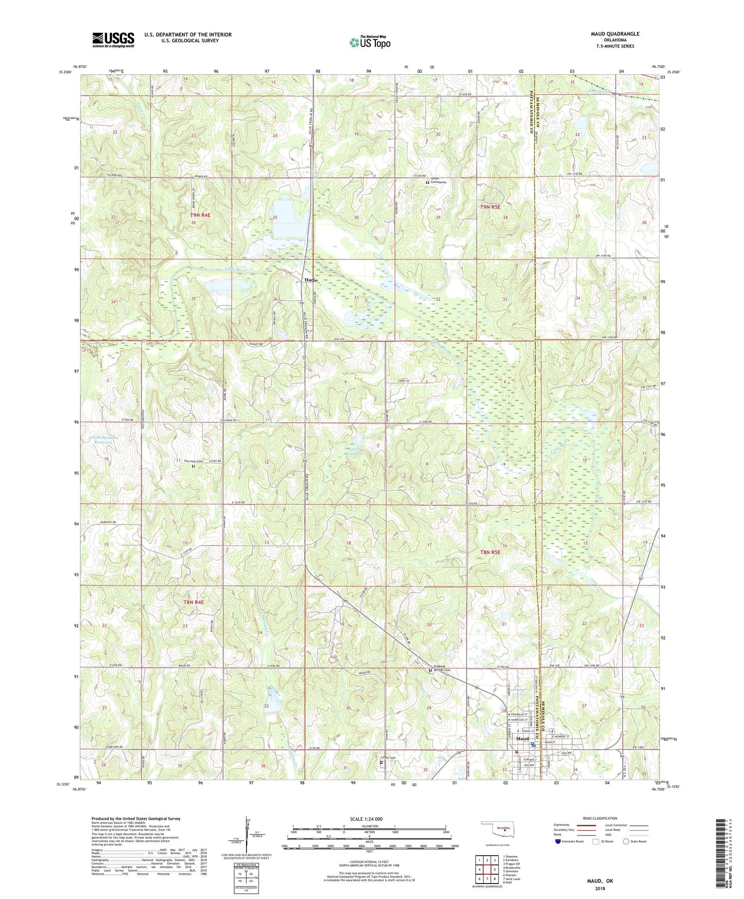
Maud Oklahoma US Topo Map
Couldn't load pickup availability
2022 topographic map quadrangle Maud in the state of Oklahoma. Scale: 1:24000. Based on the newly updated USGS 7.5' US Topo map series, this map is in the following counties: Pottawatomie, Seminole. The map contains contour data, water features, and other items you are used to seeing on USGS maps, but also has updated roads and other features. This is the next generation of topographic maps. Printed on high-quality waterproof paper with UV fade-resistant inks.
Quads adjacent to this one:
West: Brooksville
Northwest: Shawnee
North: Earlsboro
Northeast: Prague SW
East: Seminole
Southeast: Wolf
South: Saint Louis
Southwest: Pearson
This map covers the same area as the classic USGS quad with code o35096b7.
Contains the following named places: Big Wewoka Creek Site 1 Dam, Big Wewoka Creek Site 1 Reservoir, Big Wewoka Creek Site 2 Dam, Big Wewoka Creek Site 2 Reservoir, Brier Creek, City of Maud, Cummings Cemetery, Dripping Springs Cemetery, Fairview Cemetery, Harjo, Harjo Hills Camp, J E McSpadden Dam, J E McSpadden Reservoir, Maud, Maud Elementary School, Maud Fire Department, Maud High School, Maud Middle School, Maud Police Station, Maud Post Office, Oknoname 12516 Dam, Oknoname 12516 Reservoir, Rogers Creek, Salt Creek Site 27 Dam, Salt Creek Site 27 Reservoir, Township of Earlsboro, Tyner Creek, Union Cemetery - East