MyTopo
Medford Oklahoma US Topo Map
Couldn't load pickup availability
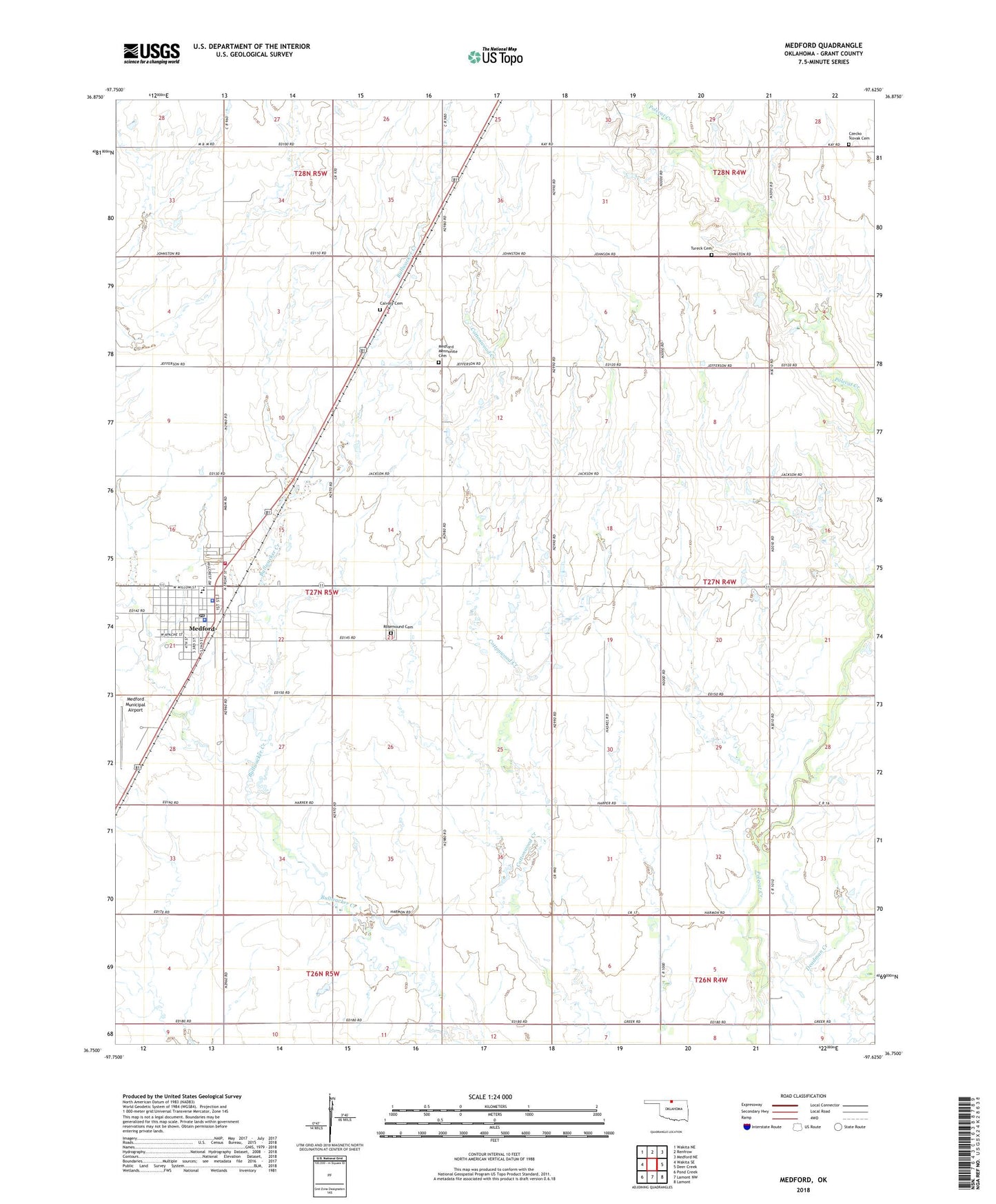
2022 topographic map quadrangle Medford in the state of Oklahoma. Scale: 1:24000. Based on the newly updated USGS 7.5' US Topo map series, this map is in the following counties: Grant. The map contains contour data, water features, and other items you are used to seeing on USGS maps, but also has updated roads and other features. This is the next generation of topographic maps. Printed on high-quality waterproof paper with UV fade-resistant inks.
Quads adjacent to this one:
West: Wakita SE
Northwest: Wakita NE
North: Renfrow
Northeast: Medford NE
East: Deer Creek
Southeast: Lamont
South: Lamont NW
Southwest: Pond Creek
This map covers the same area as the classic USGS quad with code o36097g6.
Contains the following named places: Calvary Cemetery, CC and M Airport, City of Medford, Czecko Slovak Cemetery, First Christian Church, Grant County Jail, Grant County Sheriff's Office, Medford, Medford Church, Medford Division, Medford Elementary School, Medford Golf Course, Medford High School, Medford Mennonite Cemetery, Medford Municipal Airport, Medford Police Department, Medford Post Office, Medford Volunteer Fire Department and Ambulance Service, Nazarene Church, Numa Oil Field, Rosemound Cemetery, Saint Marys Catholic Church, Saint Marys Parish Hall, Township of Medford, Tureck Cemetery, United Methodist Church, ZIP Code: 73759