MyTopo
Ratliff City Oklahoma US Topo Map
Couldn't load pickup availability
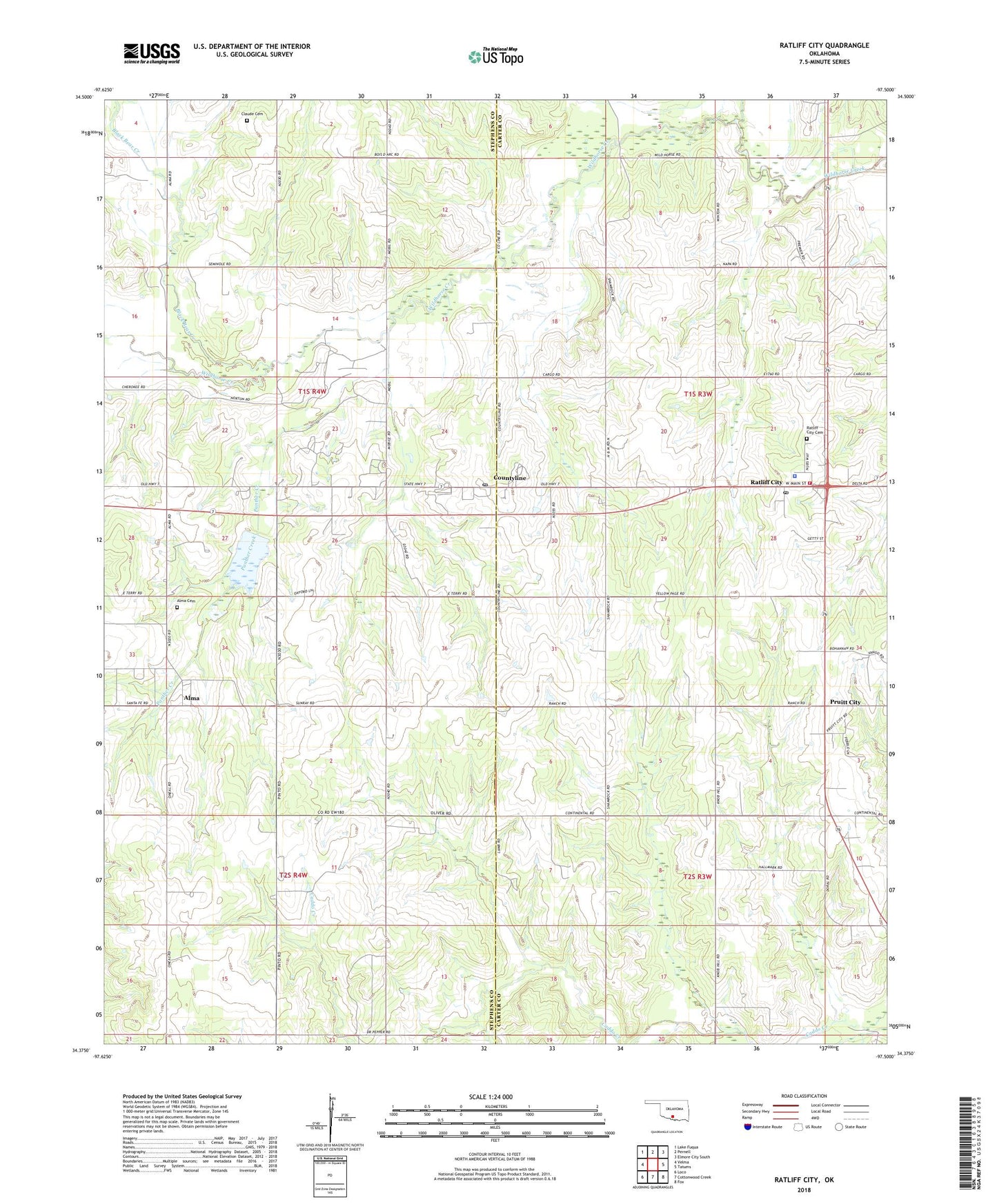
2018 topographic map quadrangle Ratliff City in the state of Oklahoma. Scale: 1:24000. Based on the newly updated USGS 7.5' US Topo map series, this map is in the following counties: Stephens, Carter. The map contains contour data, water features, and other items you are used to seeing on USGS maps, but also has updated roads and other features. This is the next generation of topographic maps. Printed on high-quality waterproof paper with UV fade-resistant inks.
Quads adjacent to this one:
West: Velma
Northwest: Lake Fuqua
North: Pernell
Northeast: Elmore City South
East: Tatums
Southeast: Fox
South: Cottonwood Creek
Southwest: Loco
Contains the following named places: Alma, Alma Cemetery, Black Bear Creek, Claud Cemetery, Countyline, Countyline Post Office, Freewill Church, Panther Creek, Pruitt City, Ratliff City, Ratliff City Cemetery, Ratliff City Police Department, Ratliff City Post Office, Ratliff City Volunteer Fire Department, Sandy Bear Creek, Town of Ratliff City, United Church, Wildhorse Creek Site 14 Dam, Wildhorse Creek Site 14 Reservoir, ZIP Codes: 73425, 73481