MyTopo
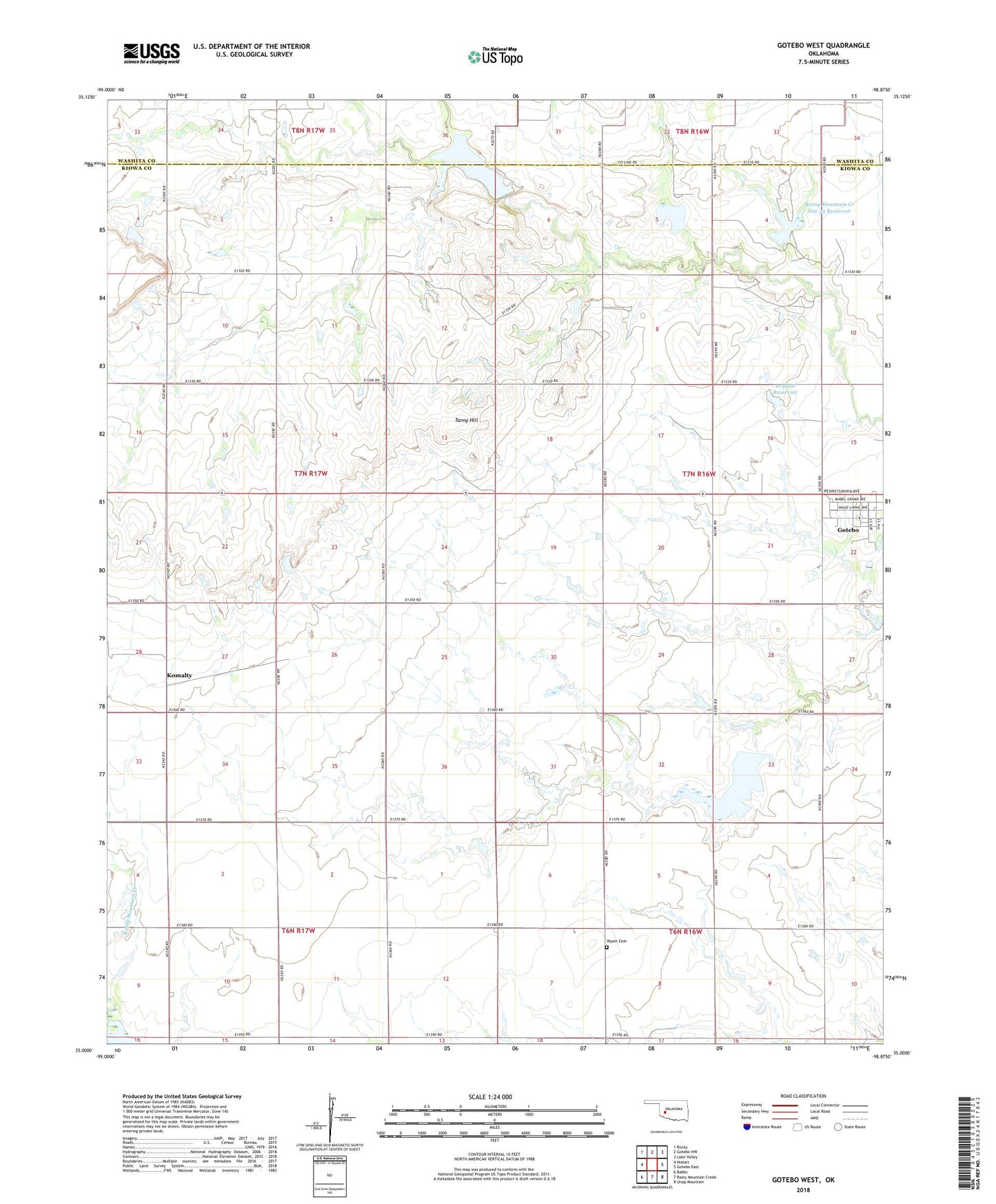
Gotebo West Oklahoma US Topo Map
Couldn't load pickup availability
2022 topographic map quadrangle Gotebo West in the state of Oklahoma. Scale: 1:24000. Based on the newly updated USGS 7.5' US Topo map series, this map is in the following counties: Kiowa, Washita. The map contains contour data, water features, and other items you are used to seeing on USGS maps, but also has updated roads and other features. This is the next generation of topographic maps. Printed on high-quality waterproof paper with UV fade-resistant inks.
Quads adjacent to this one:
West: Hobart
Northwest: Rocky
North: Gotebo NW
Northeast: Lake Valley
East: Gotebo East
Southeast: Unap Mountain
South: Rainy Mountain Creek
Southwest: Babbs
This map covers the same area as the classic USGS quad with code o35098a8.
Contains the following named places: Bible Baptist Church, Komalty, Oknoname 051001 Dam, Oknoname 051001 Reservoir, Oknoname 075008 Dam, Oknoname 075008 Reservoir, Rainy Mountain Creek Site 29a Dam, Rainy Mountain Creek Site 29a Reservoir, Rainy Mountain Creek Site 30 Dam, Rainy Mountain Creek Site 30 Reservoir, Rainy Mountain Creek Site 31 Dam, Rainy Mountain Creek Site 31 Reservoir, Rainy Mountain Creek Site 32 Dam, Rainy Mountain Creek Site 32 Reservoir, Rainy Mountain Creek Site 33 Dam, Rainy Mountain Creek Site 33 Reservoir, Tanny Hill, Wyatt Cemetery, ZIP Code: 73041