MyTopo
Rose Oklahoma US Topo Map
Couldn't load pickup availability
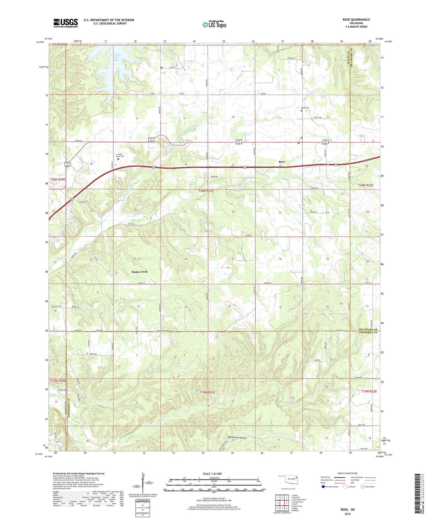
2019 topographic map quadrangle Rose in the state of Oklahoma. Scale: 1:24000. Based on the newly updated USGS 7.5' US Topo map series, this map is in the following counties: Mayes, Cherokee, Delaware. The map contains contour data, water features, and other items you are used to seeing on USGS maps, but also has updated roads and other features. This is the next generation of topographic maps. Printed on high-quality waterproof paper with UV fade-resistant inks.
Quads adjacent to this one:
West: Locust Grove
Northwest: Salina
North: Salina SE
Northeast: Lake Eucha West
East: Leach
Southeast: Moodys
South: Peggs
Southwest: Cedar Crest
Contains the following named places: Blacksmith Hollow, Bryant Creek, Chimney Rock Lake, Chimney Rock Volunteer Fire Department, Chimney Rock Volunteer Fire Department Station 2, Little Rock, Little Rock Cemetery, Little Rock Census Designated Place, Little Rock Church, Little Rock School, Little Spring Creek, Mayes Non-Community, Rose, Rose Cemetery, Rose Census Designated Place, Rose Lookout Tower, Rose Post Office, Smith Chapel, Snake Creek, Snake Creek Census Designated Place, Snake Creek Church