MyTopo
Moodys Oklahoma US Topo Map
Couldn't load pickup availability
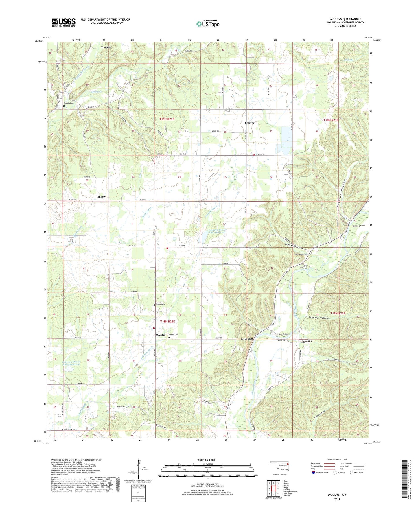
2022 topographic map quadrangle Moodys in the state of Oklahoma. Scale: 1:24000. Based on the newly updated USGS 7.5' US Topo map series, this map is in the following counties: Cherokee. The map contains contour data, water features, and other items you are used to seeing on USGS maps, but also has updated roads and other features. This is the next generation of topographic maps. Printed on high-quality waterproof paper with UV fade-resistant inks.
Quads adjacent to this one:
West: Peggs
Northwest: Rose
North: Leach
Northeast: Kansas
East: Chewey
Southeast: Proctor
South: Tahlequah
Southwest: Thompson Corner
This map covers the same area as the classic USGS quad with code o36094a8.
Contains the following named places: Agent Cemetery, Combs Bridge, Double Spring Creek, Eagles Bluff, Ellerville, Faith Chapel, Fourteen Mile Creek Site 1 Dam, Fourteen Mile Creek Site 1 Reservoir, Fourteen Mile Creek Site 2 Dam, Fourteen Mile Creek Site 2 Reservoir, Grace Chapel, Hanging Rock, Johnson Prairie, Johnson Prairie Census Designated Place, Johnson Prairie Church, Liberty, Lowrey, Lowrey Census Designated Place, Lowrey Public School, Lowrey Volunteer Fire Department Station, Lowrey Volunteer Fire Department Station 2, Lowrey Volunteer Fire Department Station 3, Molly Field Church, Molly Field Hollow, Molly Fields Cemetery, Moodys, Moodys Cemetery, Moodys Census Designated Place, Moodys Post Office, North Cherokee Division, Olive Church, Peavine Hollow, Peavine Hollow Public Access Area, Pumpkin Spring, Telamay Hollow, Teresita, Teresita Cemetery, Teresita Census Designated Place, Township of Moodys