MyTopo
Leach Oklahoma US Topo Map
Couldn't load pickup availability
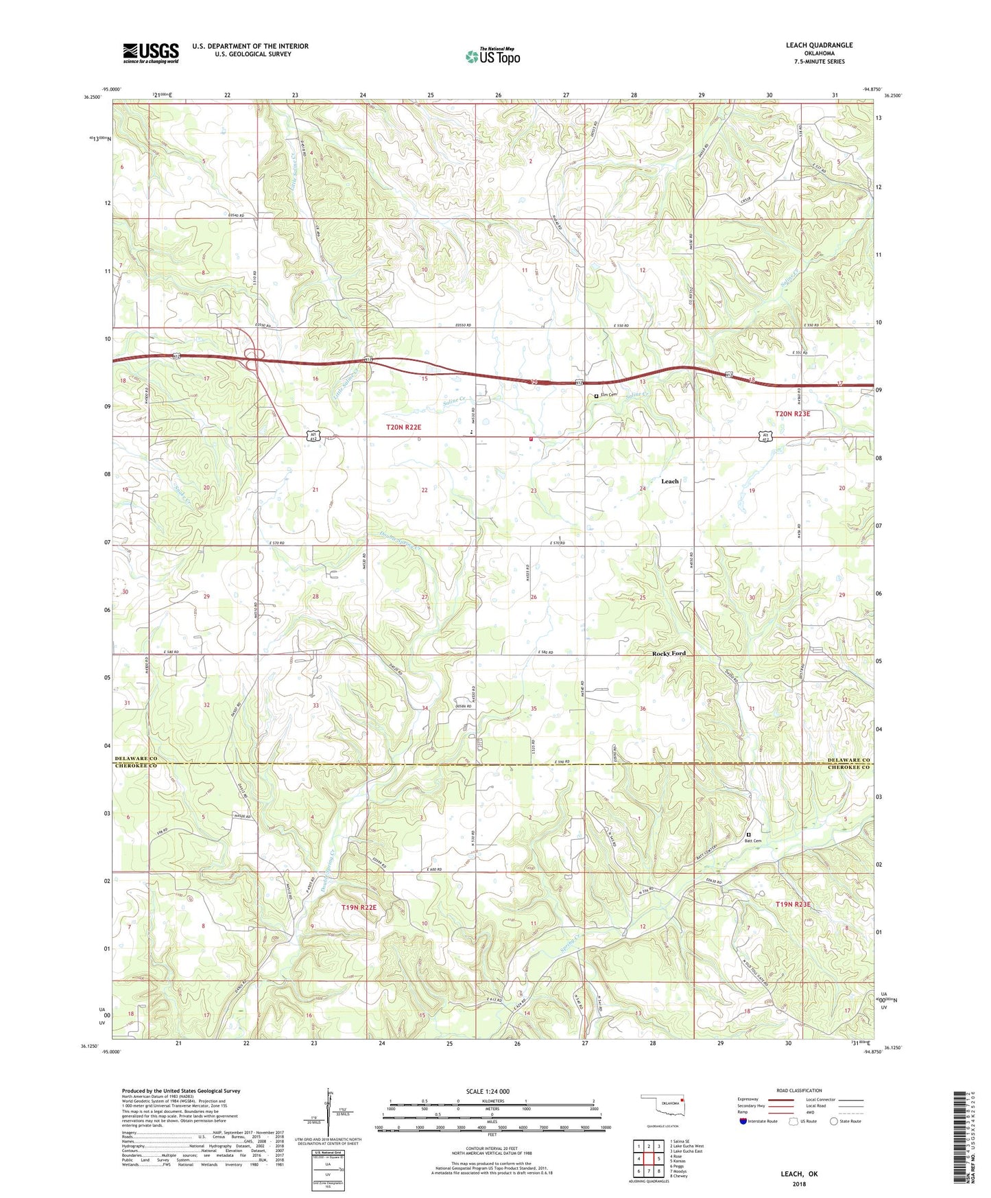
2022 topographic map quadrangle Leach in the state of Oklahoma. Scale: 1:24000. Based on the newly updated USGS 7.5' US Topo map series, this map is in the following counties: Delaware, Cherokee. The map contains contour data, water features, and other items you are used to seeing on USGS maps, but also has updated roads and other features. This is the next generation of topographic maps. Printed on high-quality waterproof paper with UV fade-resistant inks.
Quads adjacent to this one:
West: Rose
Northwest: Salina SE
North: Lake Eucha West
Northeast: Lake Eucha East
East: Kansas
Southeast: Chewey
South: Moodys
Southwest: Peggs
This map covers the same area as the classic USGS quad with code o36094b8.
Contains the following named places: Batt Church, Bill Batt Cemetery, Buffalo Church, Elm Cemetery, Elm Church, Leach, Leach Census Designated Place, Leach Community Fire Department, Leach Elementary School, Lowery Church, New Mission Church, Rocky Ford, Rocky Ford Census Designated Place, Rocky Ford State Park, Rockyford Church, Rockyford School, Teresita, Timber Grove Church, Township 1, ZIP Code: 74364