MyTopo
Lake Eucha West Oklahoma US Topo Map
Couldn't load pickup availability
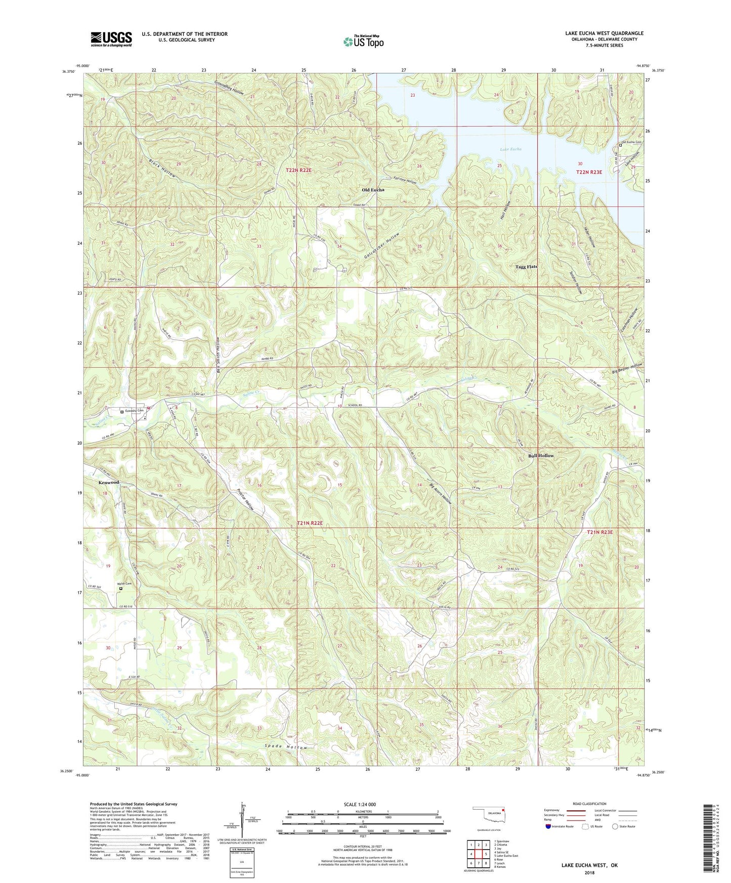
2022 topographic map quadrangle Lake Eucha West in the state of Oklahoma. Scale: 1:24000. Based on the newly updated USGS 7.5' US Topo map series, this map is in the following counties: Delaware. The map contains contour data, water features, and other items you are used to seeing on USGS maps, but also has updated roads and other features. This is the next generation of topographic maps. Printed on high-quality waterproof paper with UV fade-resistant inks.
Quads adjacent to this one:
West: Salina SE
Northwest: Spavinaw
North: Chloeta
Northeast: Jay
East: Lake Eucha East
Southeast: Kansas
South: Leach
Southwest: Rose
This map covers the same area as the classic USGS quad with code o36094c8.
Contains the following named places: Ben Smith Hollow, Big Acorn Hollow, Bull Hollow, Bull Hollow Census Designated Place, Estelle Church, Euwasha Cemetery, Fairview Hollow, Galcatcher Hollow, Groundhog Hollow, Hail Hollow, Hider Hollow, Kansas Division, Kenwood, Kenwood Census Designated Place, Kenwood Elementary School, Kenwood Volunteer Fire Department, Lane Hollow, Old Eucha, Old Eucha Cemetery, Old Eucha Census Designated Place, Proctor Hollow, Public Hunting Area, Refuge Headquaters, Soldier Hollow, Spade Hollow, Spavinaw Hills State Game Refuge, Tagg Flats, Tagg Flats Census Designated Place, Welch Prairie Cemetery