MyTopo
Taloga Oklahoma US Topo Map
Couldn't load pickup availability
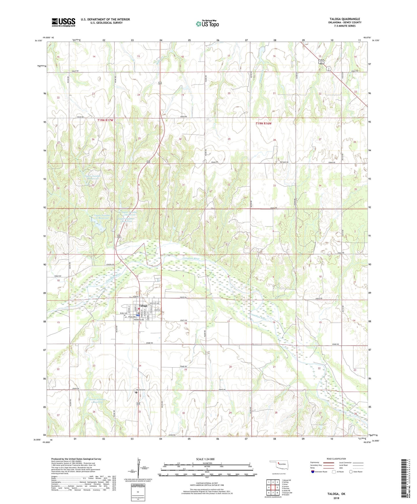
2022 topographic map quadrangle Taloga in the state of Oklahoma. Scale: 1:24000. Based on the newly updated USGS 7.5' US Topo map series, this map is in the following counties: Dewey. The map contains contour data, water features, and other items you are used to seeing on USGS maps, but also has updated roads and other features. This is the next generation of topographic maps. Printed on high-quality waterproof paper with UV fade-resistant inks.
Quads adjacent to this one:
West: Lenora
Northwest: Mutual NE
North: Seiling
Northeast: Orion
East: Hucmac
Southeast: Parallel
South: Putnam NW
Southwest: Aledo NE
This map covers the same area as the classic USGS quad with code o36098a8.
Contains the following named places: Dewey County Jail, Dewey County Sheriff's Office, Kouns Number 1 Dam, Kouns Number 1 Reservoir, Leedey Police Department, Mound Cemetery, Taloga, Taloga Ambulance, Taloga Elementary School, Taloga Fire Department, Taloga High School, Taloga Post Office, Taylor Number 10 Dam, Taylor Number 10 Reservoir, Taylor Number 3 Dam, Taylor Number 3 Reservoir, Taylor Number 4 Dam, Taylor Number 4 Reservoir, Taylor Number 5 Dam, Taylor Number 5 Reservoir, Town of Taloga, Township of Seiling, Township of Taloga, ZIP Code: 73663