MyTopo
Higgins North Texas US Topo Map
Couldn't load pickup availability
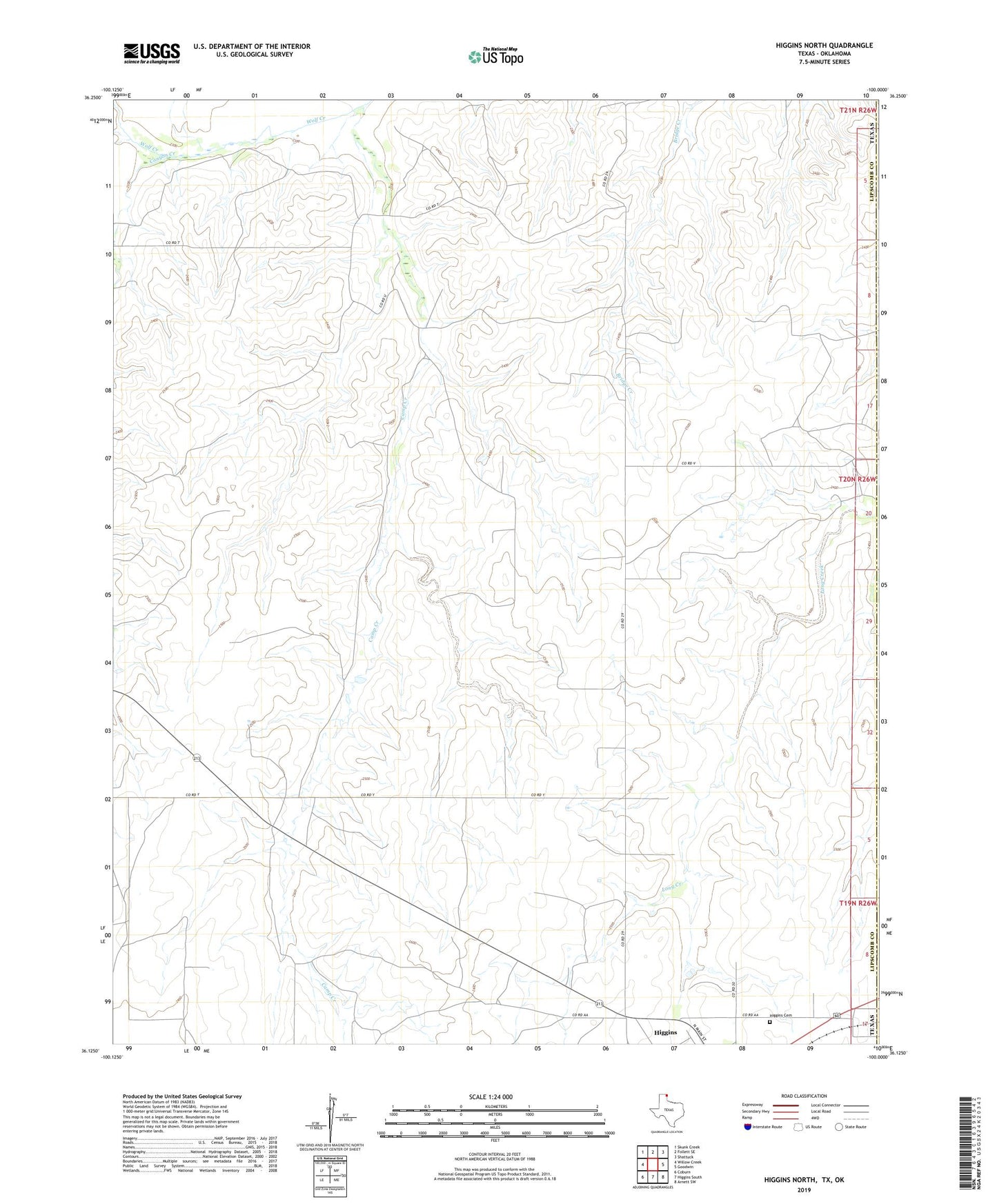
2022 topographic map quadrangle Higgins North in the state of Texas. Scale: 1:24000. Based on the newly updated USGS 7.5' US Topo map series, this map is in the following counties: Lipscomb, Ellis. The map contains contour data, water features, and other items you are used to seeing on USGS maps, but also has updated roads and other features. This is the next generation of topographic maps. Printed on high-quality waterproof paper with UV fade-resistant inks.
Quads adjacent to this one:
West: Willow Creek
Northwest: Skunk Creek
North: Follett SE
Northeast: Shattuck
East: Goodwin
Southeast: Arnett SW
South: Higgins South
Southwest: Coburn
This map covers the same area as the classic USGS quad with code o36100b1.
Contains the following named places: Camp Creek, Canyon Creek, Higgins Cemetery, ZIP Code: 79046