MyTopo
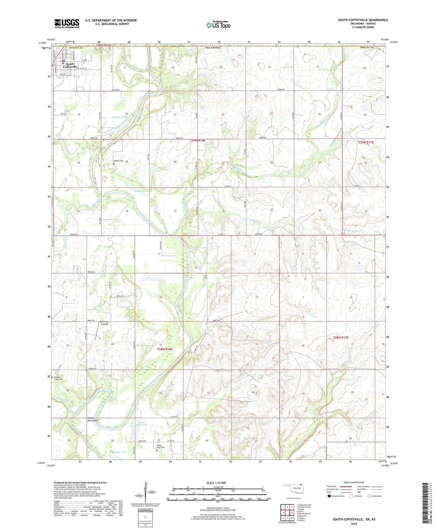
South Coffeyville Oklahoma US Topo Map
Couldn't load pickup availability
2019 topographic map quadrangle South Coffeyville in the states of Oklahoma, Kansas. Scale: 1:24000. Based on the newly updated USGS 7.5' US Topo map series, this map is in the following counties: Nowata, Montgomery, Labette. The map contains contour data, water features, and other items you are used to seeing on USGS maps, but also has updated roads and other features. This is the next generation of topographic maps. Printed on high-quality waterproof paper with UV fade-resistant inks.
Quads adjacent to this one:
West: Elliott
Northwest: Coffeyville West
North: Coffeyville East
Northeast: Valeda
East: Hayrick Mound
Southeast: Sanders
South: Childers
Southwest: Delaware
Contains the following named places: Belleview Landing, Chouteau Lake, Crow Hollow Creek, Goose Neck Bend, Goose Neck Cemetery, Goose Neck Lake, Hickory Creek, Hickory Creek Cemetery, Melton Cemetery, Melton Lake, Onion Creek, Opossum Creek, Rock Creek, Snow Creek, South Coffeyville, South Coffeyville Elementary School, South Coffeyville Fire Department, South Coffeyville High School, South Coffeyville Police Department, South Coffeyville Post Office, Taylor Lake, Town of South Coffeyville, Vinegar Creek, ZIP Code: 74072