MyTopo
Sanders Oklahoma US Topo Map
Couldn't load pickup availability
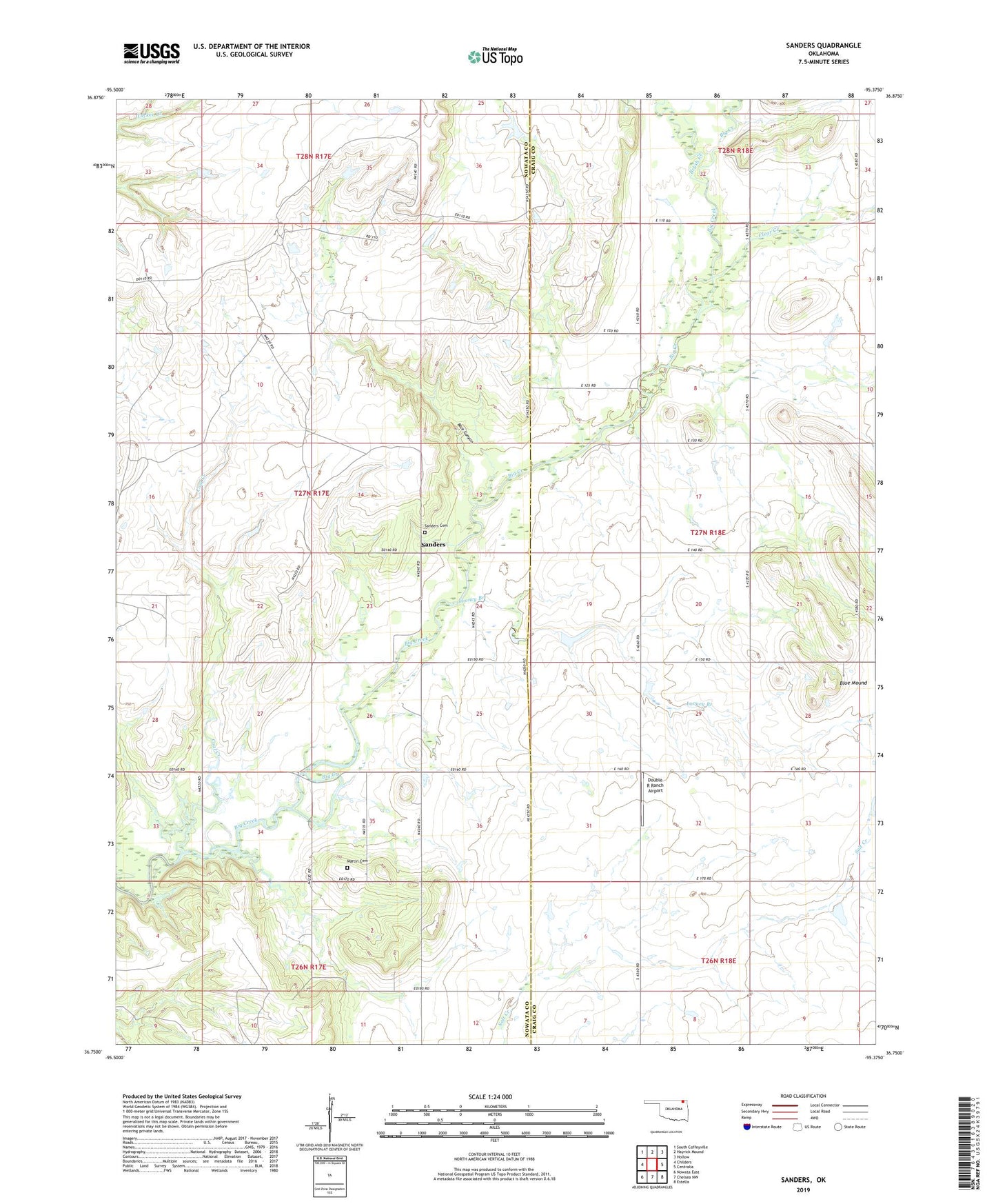
2022 topographic map quadrangle Sanders in the state of Oklahoma. Scale: 1:24000. Based on the newly updated USGS 7.5' US Topo map series, this map is in the following counties: Nowata, Craig. The map contains contour data, water features, and other items you are used to seeing on USGS maps, but also has updated roads and other features. This is the next generation of topographic maps. Printed on high-quality waterproof paper with UV fade-resistant inks.
Quads adjacent to this one:
West: Childers
Northwest: South Coffeyville
North: Hayrick Mound
Northeast: Hollow
East: Centralia
Southeast: Estella
South: Chelsea NW
Southwest: Nowata East
This map covers the same area as the classic USGS quad with code o36095g4.
Contains the following named places: Blue Canyon, Blue Mound, Brush Creek, Clear Creek, Coal Creek, Double R Ranch Airport, Halsell Ranch, Happy Hill Church, Looney Branch, Martin Cemetery, Sanders, Sanders Cemetery, Township of Armstrong, Twin Bridges, Twin Bridges Community Center