MyTopo
Coffeyville East Kansas US Topo Map
Couldn't load pickup availability
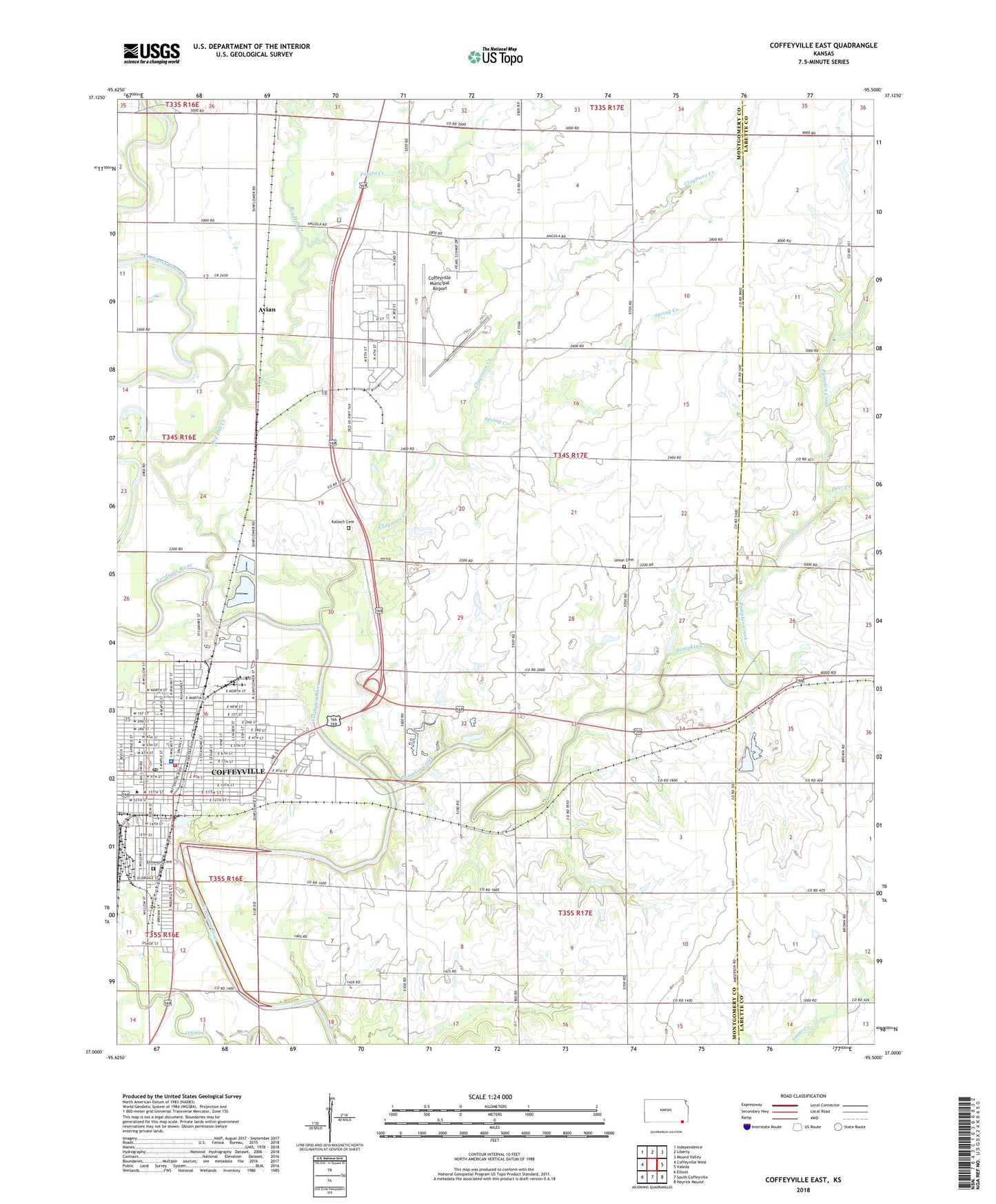
2022 topographic map quadrangle Coffeyville East in the state of Kansas. Scale: 1:24000. Based on the newly updated USGS 7.5' US Topo map series, this map is in the following counties: Montgomery, Labette. The map contains contour data, water features, and other items you are used to seeing on USGS maps, but also has updated roads and other features. This is the next generation of topographic maps. Printed on high-quality waterproof paper with UV fade-resistant inks.
Quads adjacent to this one:
West: Coffeyville West
Northwest: Independence
North: Liberty
Northeast: Mound Valley
East: Valeda
Southeast: Hayrick Mound
South: South Coffeyville
Southwest: Elliott
This map covers the same area as the classic USGS quad with code o37095a5.
Contains the following named places: Amazing Grace Chapel, Avian, Bartlett Milling Company Grain Elevator Number 1, Bethel African Methodist Episcopal Church, Bethel Church, Big Hill Creek, Blue Ribbon School, Brown Mansion, Calvary Baptist Church, Church of God in Christ, Claymore Creek, Claymore School, Cleveland School, Coffeyville, Coffeyville Army Air Field, Coffeyville City Hall, Coffeyville Community College, Coffeyville Industrial Park, Coffeyville Municipal Airport, Coffeyville Post Office, Coffeyville Public Library, Coffeyville Wastewater Treatment Facility, Cotton Creek, Dalton Museum, Deer Creek, Elmwood Cemetery, Emmanuel Southern Baptist Church, First Baptist Church, First Christian Church, First Presbyterian Church, First United Methodist Church, Holy Name Catholic Church, Holy Name Catholic School, Kalloch, Kalloch Cemetery, Kallock School, Life Improvement Network Center, Longfellow Elementary School, Lowell Elementary School, McKennon School, Montgomery County District Court Coffeyville, Montgomery County Health Department, Parker School, Pioneer Kansas American Red Cross, Potato Creek, Pumpkin Creek, Roberts School, Saint James United Methodist Church, Saint John's Church, Saint Paul's Episcopal Church, Saint Paul's Lutheran Church, Sardis Baptist Church, Snow School, Spring Creek, Stony Point School, Township of Cherokee, Union Cemetery, Videtta Spur, Walter Johnson Park Rodeo Arena, Walter Johnson School, Whittier Elementary School, ZIP Code: 67337