MyTopo
Hayrick Mound Oklahoma US Topo Map
Couldn't load pickup availability
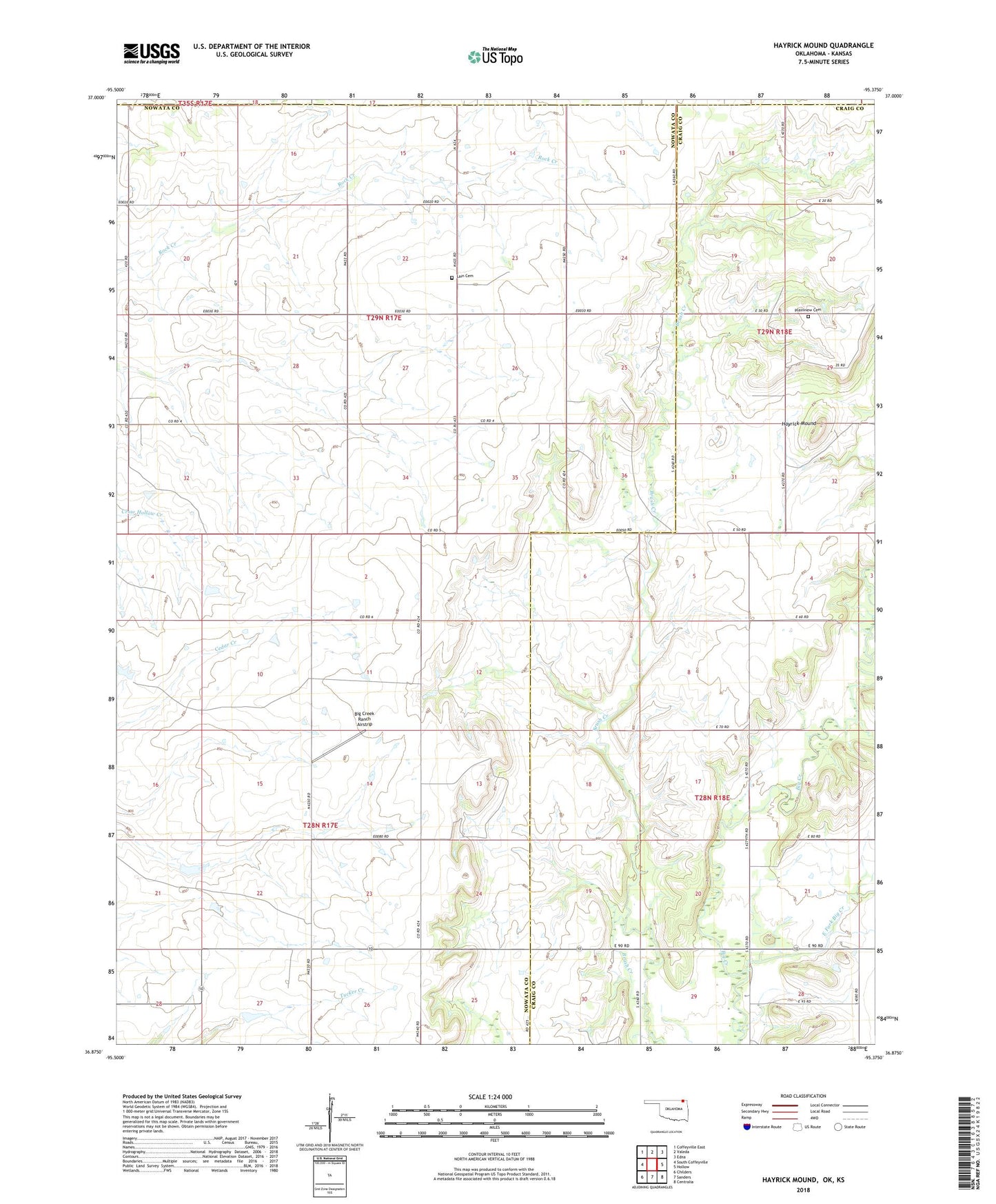
2022 topographic map quadrangle Hayrick Mound in the state of Oklahoma. Scale: 1:24000. Based on the newly updated USGS 7.5' US Topo map series, this map is in the following counties: Nowata, Craig, Labette. The map contains contour data, water features, and other items you are used to seeing on USGS maps, but also has updated roads and other features. This is the next generation of topographic maps. Printed on high-quality waterproof paper with UV fade-resistant inks.
Quads adjacent to this one:
West: South Coffeyville
Northwest: Coffeyville East
North: Valeda
Northeast: Edna
East: Hollow
Southeast: Centralia
South: Sanders
Southwest: Childers
This map covers the same area as the classic USGS quad with code o36095h4.
Contains the following named places: Big Creek Ranch Airstrip, East Fork Big Creek, Hayrick Mound, Lain Cemetery, Plainview Cemetery, Pleasant View Church, Rock Creek Church, Township of Snow Creek, Wimer Community Church