MyTopo
Spavinaw Oklahoma US Topo Map
Couldn't load pickup availability
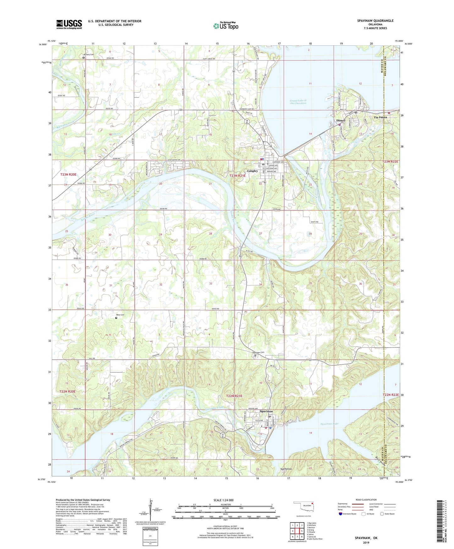
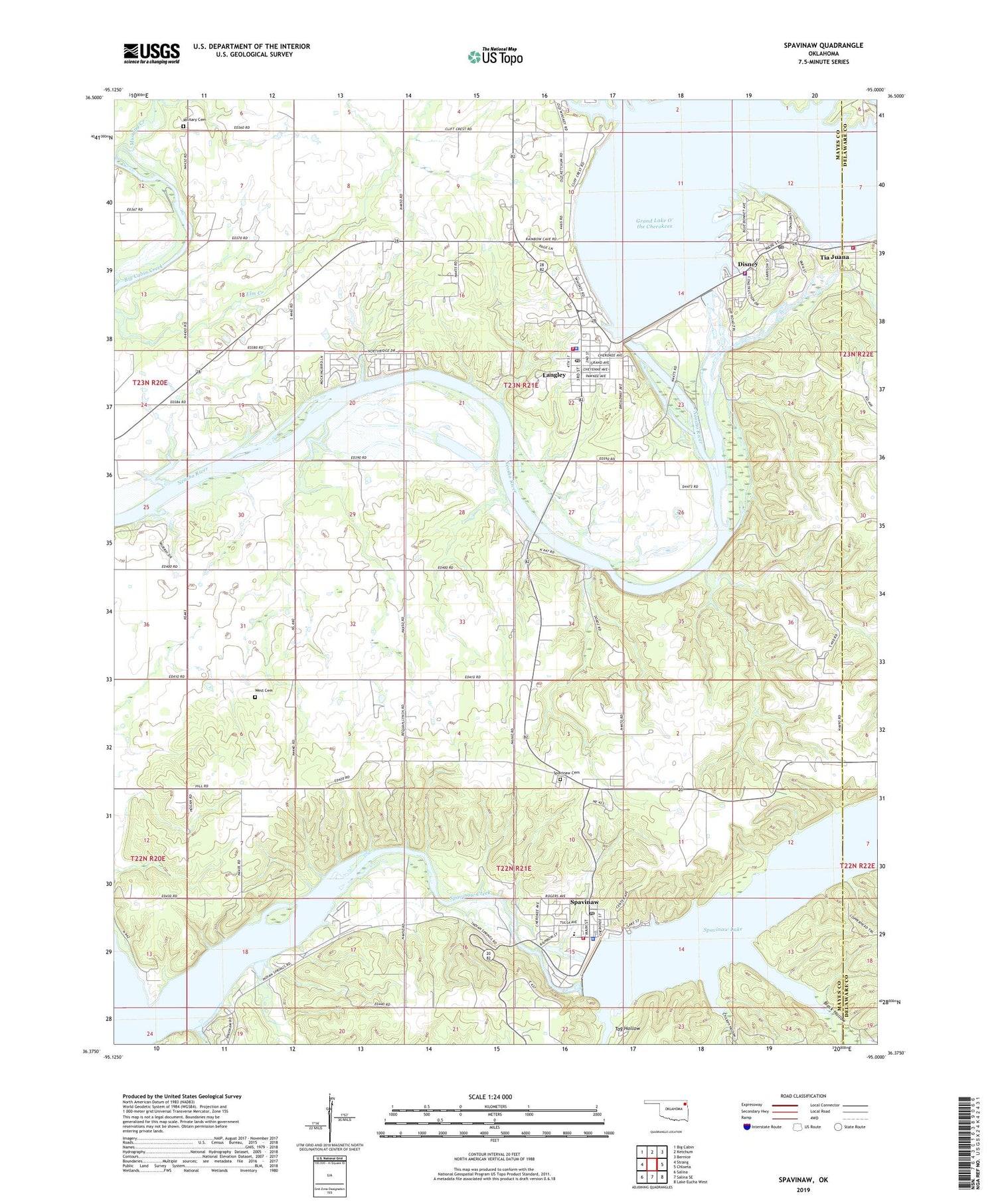
2019 topographic map quadrangle Spavinaw in the state of Oklahoma. Scale: 1:24000. Based on the newly updated USGS 7.5' US Topo map series, this map is in the following counties: Mayes, Delaware. The map contains contour data, water features, and other items you are used to seeing on USGS maps, but also has updated roads and other features. This is the next generation of topographic maps. Printed on high-quality waterproof paper with UV fade-resistant inks.
Quads adjacent to this one:
West: Strang
Northwest: Big Cabin
North: Ketchum
Northeast: Bernice
East: Chloeta
Southeast: Lake Eucha West
South: Salina SE
Southwest: Salina
Contains the following named places: Black Hollow, Cherokee State Park, Chicken Hollow, City of Vinita Water Intake, Disney, Disney Fire Department, Disney Police Department, Disney Post Office, East Mayes Division, Grand River Dam Lake Patrol, Grandcraft Landing Strip, Langley, Langley Fire Department, Langley Police Department, Langley Post Office, Little Blue-Disney State Park, Military Cemetery, Military Church, Mustang Creek, Pensacola Dam, Recreation Area Number 1, Recreation Area Number 2, Recreation Area Number 3, Red Stevenson Property Heliport, Ribbon Church, Spavinaw, Spavinaw Cemetery, Spavinaw Creek, Spavinaw Dam, Spavinaw Fire Department, Spavinaw Lake, Spavinaw Police Department, Spavinaw Post Office, Spavinaw School, Spavinaw State Park, Sportmans Shores Census Designated Place, Summerfield Creek, Tag Hollow, Tia Juana, Tia Juana Fire Department, Town of Disney, Town of Langley, Town of Spavinaw, Township of River, West Cemetery, ZIP Codes: 74340, 74350, 74366, 74367