MyTopo
Dougherty Oklahoma US Topo Map
Couldn't load pickup availability
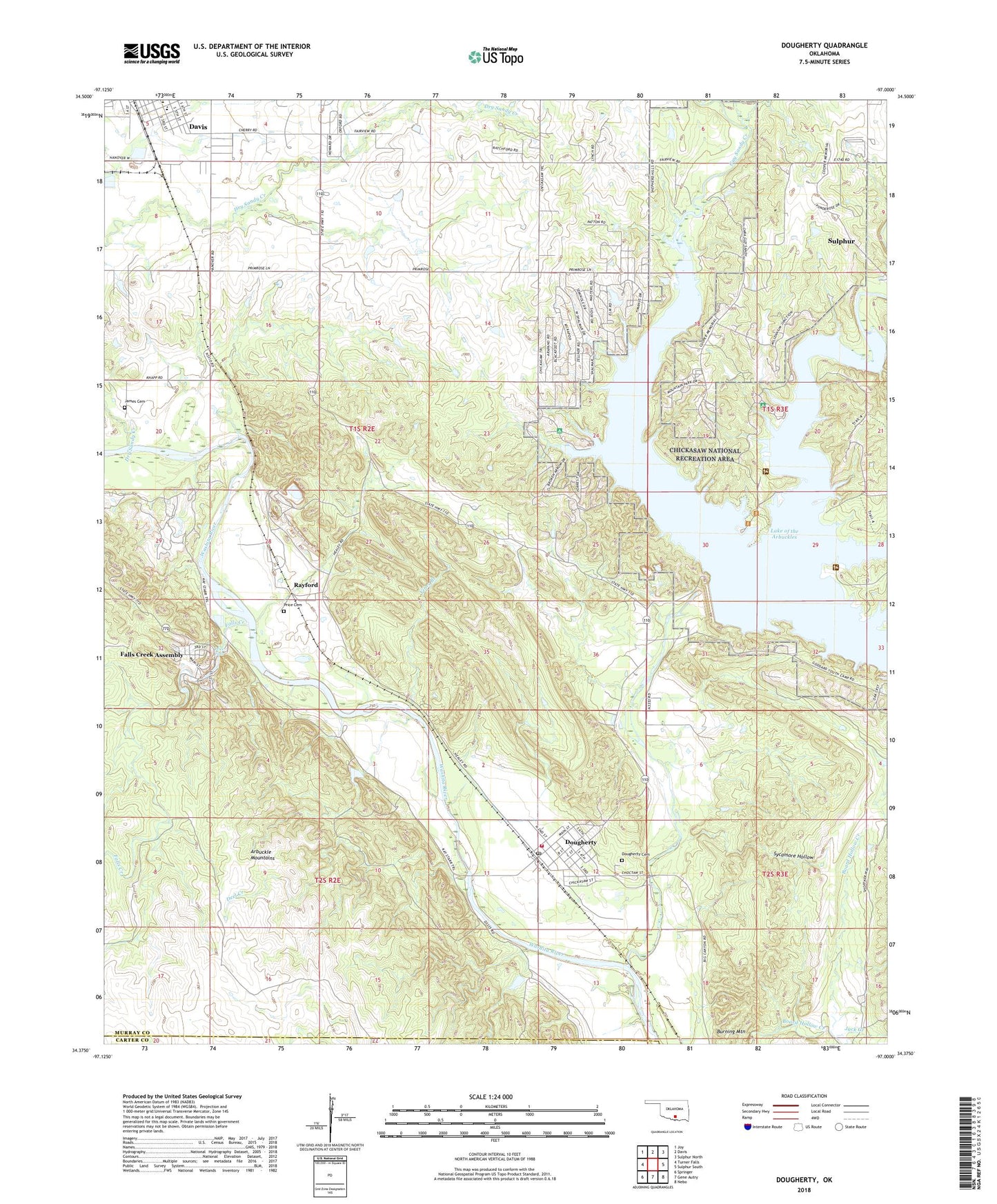
2022 topographic map quadrangle Dougherty in the state of Oklahoma. Scale: 1:24000. Based on the newly updated USGS 7.5' US Topo map series, this map is in the following counties: Murray, Carter. The map contains contour data, water features, and other items you are used to seeing on USGS maps, but also has updated roads and other features. This is the next generation of topographic maps. Printed on high-quality waterproof paper with UV fade-resistant inks.
Quads adjacent to this one:
West: Turner Falls
Northwest: Joy
North: Davis
Northeast: Sulphur North
East: Sulphur South
Southeast: Nebo
South: Gene Autry
Southwest: Springer
This map covers the same area as the classic USGS quad with code o34097d1.
Contains the following named places: Amos Construction Company Dam, Amos Construction Company Reservoir, Arbuckle Lake Dam, Baptist Lake, Burning Mountain, Chickasaw National Recreation Area, Chickasaw Wildlife Management Areas, City of Sulphur, Davis Elementary School, Davis Middle School, Deel Creek, Dougherty, Dougherty Cemetery, Dougherty Fire Department, Dougherty Post Office, Dry Sandy Creek, Falls Creek, Falls Creek Assembly, Guy Sandy Creek, Guy Sandy Stockpond Dam, Hagee Gss Number 1 Dam, Hagee Gss Number 1 Reservoir, Honey Creek, Jack Creek, James Cemetery, Lake of the Arbuckles, Murray County, Oknoname 09902 Dam, Oknoname 09902 Reservoir, Oknoname 09903 Dam, Oknoname 09903 Reservoir, Phedford Pond Dam, Price Cemetery, Price Falls, Rayford, Rock Creek, Sycamore Hollow, Town of Dougherty, Township of Allen, Vines Branch, Vines Oil Field, ZIP Code: 73032