MyTopo
Garvin Oklahoma US Topo Map
Couldn't load pickup availability
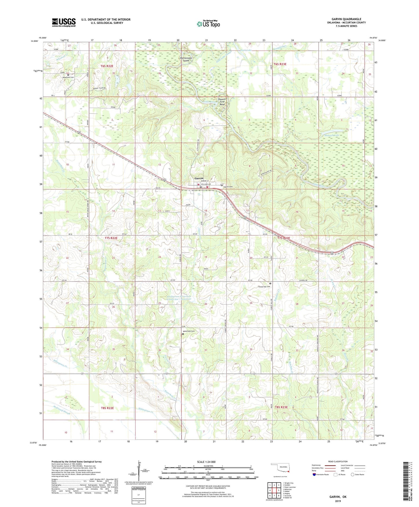
2022 topographic map quadrangle Garvin in the state of Oklahoma. Scale: 1:24000. Based on the newly updated USGS 7.5' US Topo map series, this map is in the following counties: McCurtain. The map contains contour data, water features, and other items you are used to seeing on USGS maps, but also has updated roads and other features. This is the next generation of topographic maps. Printed on high-quality waterproof paper with UV fade-resistant inks.
Quads adjacent to this one:
West: Millerton
Northwest: Wright City
North: Golden
Northeast: Steel Junction
East: Idabel
Southeast: Idabel SE
South: Acworth
Southwest: Negley
This map covers the same area as the classic USGS quad with code o33094h8.
Contains the following named places: Antioch Church, Bokchito Church, Campbell Creek, Cisco School, Coffey Valley Church, Farmers Hill School, Forest Grove Elementary School, Forest Hill Cemetery, Forest Hill Church, Garvin, Garvin Cemetery, Garvin Creek, Garvin Post Office, Garvin Rural Volunteer Fire Department Station 1, Garvin Rural Volunteer Fire Department Station 2, Garvin School, Honey Grove School, Iron Stob Corner, Mohawk Lake, Oknoname 089001 Dam, Oknoname 089001 Reservoir, Oknoname 089005 Dam, Oknoname 089005 Reservoir, Possum Ford Bend, Rattlesnake Island, Sunk Lake, Sunk Lake Slough, Town of Garvin, Township of Kirk, Waterhole Cemetery, Waterhole Church, Wheelock Academy, Wheelock Cemetery, Whitegrass-Waterhole Creeks Site 5 Dam, Whitegrass-Waterhole Creeks Site 5 Reservoir, Whitegrass-Waterhole Creeks Site 6 Dam, Whitegrass-Waterhole Creeks Site 6 Reservoir, Whitegrass-Waterhole Creeks Site 7 Dam, Whitegrass-Waterhole Creeks Site 7 Reservoir, Whitegrass-Waterhole Creeks Site 8 Dam, Whitegrass-Waterhole Creeks Site 8 Reservoir, Whitegrass-Waterhole Creeks Site 9 Dam, Whitegrass-Waterhole Creeks Site 9 Reservoir, ZIP Code: 74736