MyTopo
Stigler NE Oklahoma US Topo Map
Couldn't load pickup availability
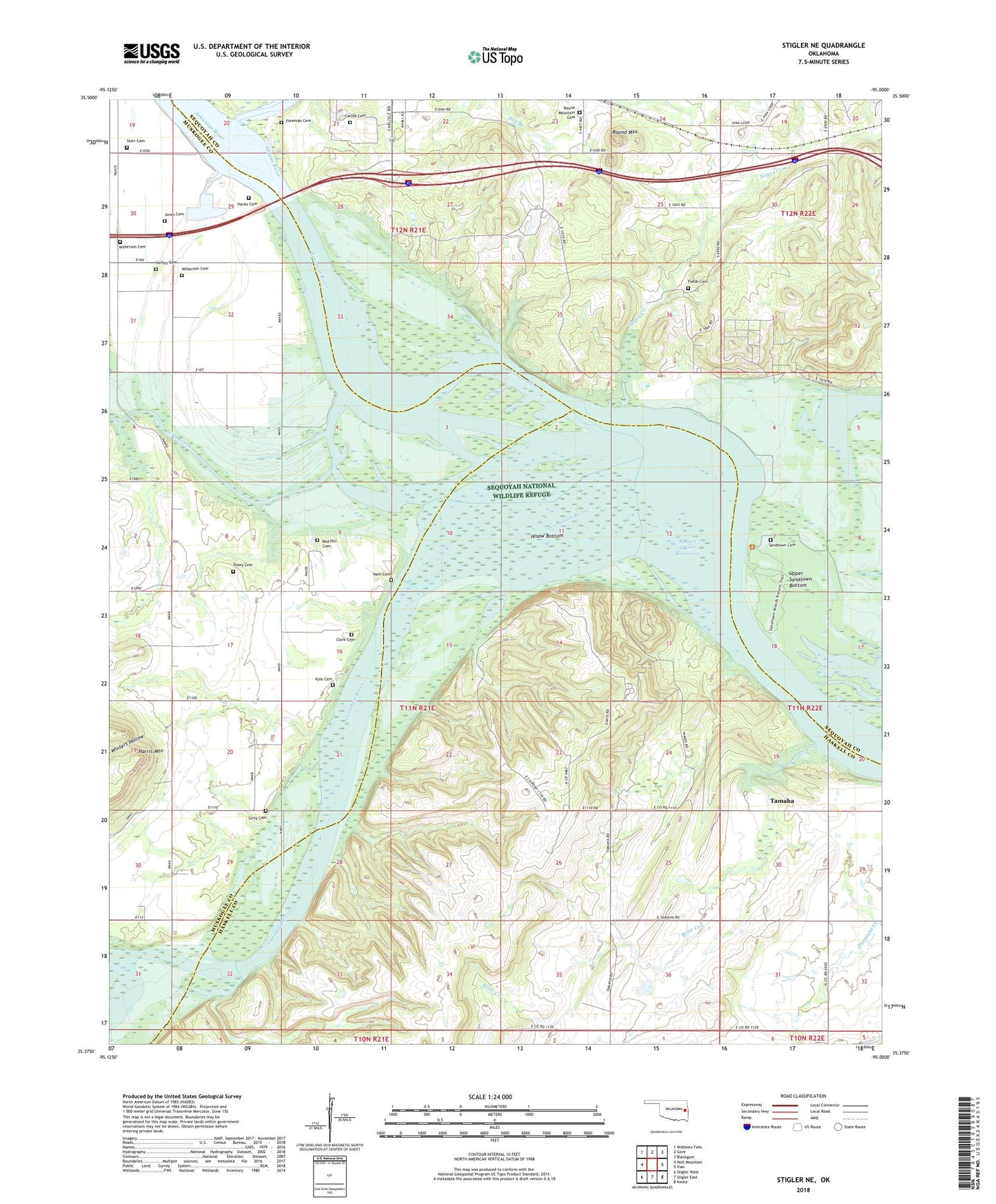
2018 topographic map quadrangle Stigler NE in the state of Oklahoma. Scale: 1:24000. Based on the newly updated USGS 7.5' US Topo map series, this map is in the following counties: Haskell, Sequoyah, Muskogee. The map contains contour data, water features, and other items you are used to seeing on USGS maps, but also has updated roads and other features. This is the next generation of topographic maps. Printed on high-quality waterproof paper with UV fade-resistant inks.
Quads adjacent to this one:
West: Holt Mountain
Northwest: Webbers Falls
North: Gore
Northeast: Blackgum
East: Vian
Southeast: Keota
South: Stigler East
Southwest: Stigler West
Contains the following named places: Brier Creek, Canadian River, Carlile Cemetery, Clark Cemetery, Dirty Creek, Fields Cemetery, Foreman Cemetery, Hanks Family Cemetery, Harris Mountain, Hefley Cemetery, Hisaw Bottom, Illinois River, Jones Cemetery, Kyle Cemetery, McIntosh Chapel, Negro Creek, Oknoname 111032 Dam, Oknoname 111032 Reservoir, Red Hill Cemetery, Rock Hill Church, Round Mountain, Round Mountain Cemetery, Round Mountain Church, Sally Jones Lake, Sandtown Cemetery, Sequoyah National Wildlife Refuge, Starr Cemetery, Stony Point Church, Tom Girty Cemetery, Toney Cemetery, Town of Tamaha, Township of Liberty, Upper Sandtown Bottom, Upson Siding, Vann Cemetery, Webbers Falls, Wilkerson Cemetery