MyTopo
Stigler West Oklahoma US Topo Map
Couldn't load pickup availability
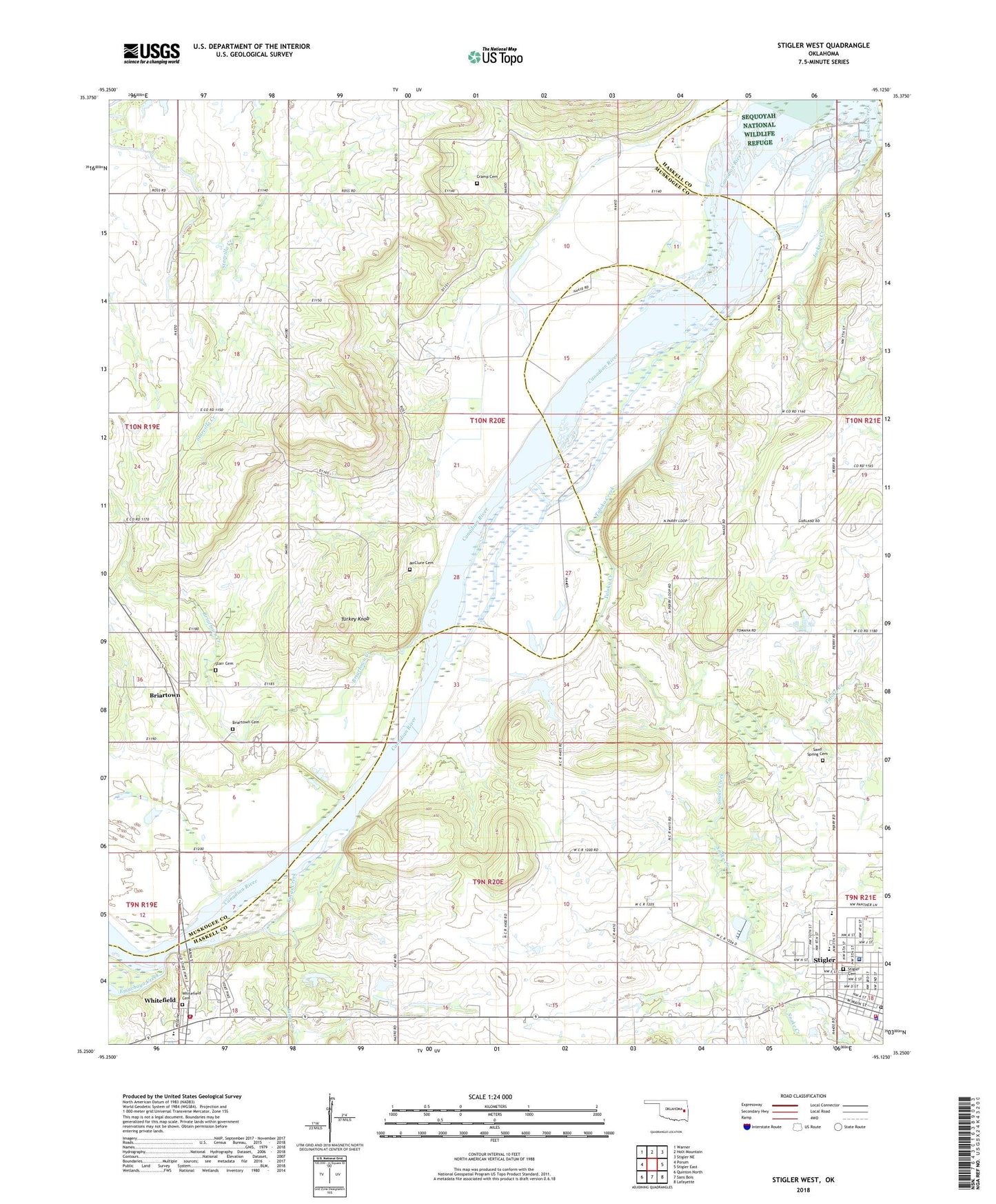
2022 topographic map quadrangle Stigler West in the state of Oklahoma. Scale: 1:24000. Based on the newly updated USGS 7.5' US Topo map series, this map is in the following counties: Haskell, Muskogee. The map contains contour data, water features, and other items you are used to seeing on USGS maps, but also has updated roads and other features. This is the next generation of topographic maps. Printed on high-quality waterproof paper with UV fade-resistant inks.
Quads adjacent to this one:
West: Porum
Northwest: Warner
North: Holt Mountain
Northeast: Stigler NE
East: Stigler East
Southeast: Lafayette
South: Sans Bois
Southwest: Quinton North
This map covers the same area as the classic USGS quad with code o35095c2.
Contains the following named places: Briartown, Briartown Cemetery, Briartown Census Designated Place, Briartown Creek, Cramp Cemetery, Emachaya Creek, Haskell County Healthcare System, Jackson Creek, Kings Creek, Martin School, McClure Cemetery, Perry School, Porum Division, Ross School, Sand Spring Cemetery, Snake Creek, Starr Family Cemetery, Stigler Cemetery, Stigler Fire Department, Stigler High School, Stigler Middle School, Stigler Police Department, Stigler Post Office, Taloka Creek, Town of Whitefield, Turkey Knob, Whitefield, Whitefield Cemetery, Whitefield Elementary School, Whitefield Post Office, Whitefield Volunteer Fire Department, ZIP Code: 74462