MyTopo
Stroud South Oklahoma US Topo Map
Couldn't load pickup availability
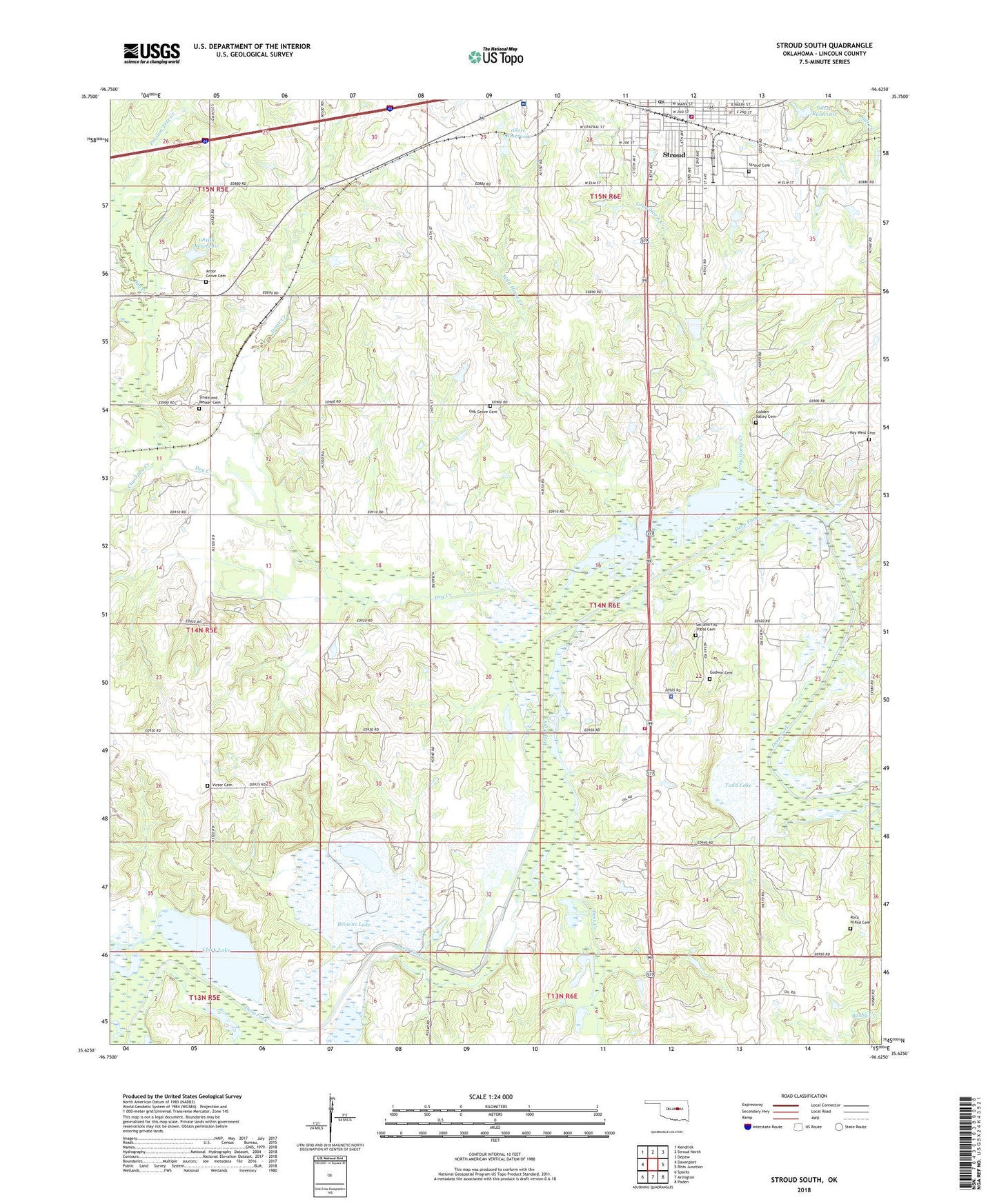
2018 topographic map quadrangle Stroud South in the state of Oklahoma. Scale: 1:24000. Based on the newly updated USGS 7.5' US Topo map series, this map is in the following counties: Lincoln. The map contains contour data, water features, and other items you are used to seeing on USGS maps, but also has updated roads and other features. This is the next generation of topographic maps. Printed on high-quality waterproof paper with UV fade-resistant inks.
Quads adjacent to this one:
West: Davenport
Northwest: Kendrick
North: Stroud North
Northeast: Depew
East: Ritts Junction
Southeast: Paden
South: Arlington
Southwest: Sparks
Contains the following named places: Arbor Grove Cemetery, Barby Creek, Brinkley Siding, Browns Lake, Chuckaho Creek, Clark Lake, Deer Creek, Dosie Creek, Dry Creek, First Christian Church, Godwin Cemetery, Golden Valley Cemetery, Gray Horse Creek, Jim Thorpe Memorial Park, Key West, Key West Cemetery, Mercy Regional Ambulance Squad, Methodist Church, Oak Grove Cemetery, Oknoname 08108 Dam, Oknoname 08108 Reservoir, Oknoname 08110 Dam, Oknoname 08110 Reservoir, Oknoname 08111 Dam, Oknoname 08111 Reservoir, Rock Island Cemetery, Sac and Fox Nation Fire Department, Sac and Fox Nation Police Department, Sac and Fox Tribal Cemetery, Smith - Messer Cemetery, Stroud, Stroud Cemetery, Stroud Fire Department, Stroud Police Department, Stroud Post Office, Stroud Regional Medical Center, Todd Lake, Township of South Keokuk, Victor Cemetery, Wild Horse Creek, ZIP Code: 74079