MyTopo
Davenport Oklahoma US Topo Map
Couldn't load pickup availability
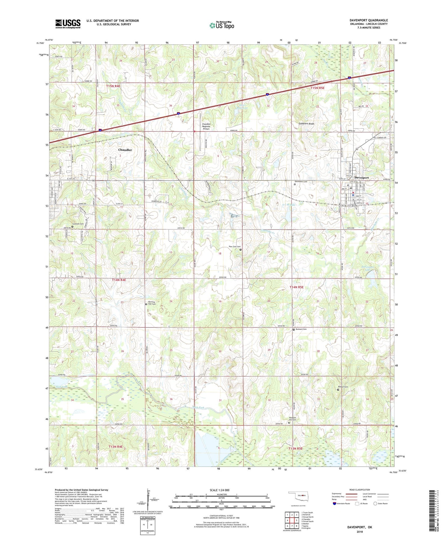
2022 topographic map quadrangle Davenport in the state of Oklahoma. Scale: 1:24000. Based on the newly updated USGS 7.5' US Topo map series, this map is in the following counties: Lincoln. The map contains contour data, water features, and other items you are used to seeing on USGS maps, but also has updated roads and other features. This is the next generation of topographic maps. Printed on high-quality waterproof paper with UV fade-resistant inks.
Quads adjacent to this one:
West: Chandler
Northwest: Tryon South
North: Kendrick
Northeast: Stroud North
East: Stroud South
Southeast: Arlington
South: Sparks
Southwest: Meeker
This map covers the same area as the classic USGS quad with code o35096f7.
Contains the following named places: A C M Dam, A C M Lake, Booker Cemetery, Cardwell Cemetery, Chandler Division, Chandler Fire Department Station 2, Chandler Regional Airport, Clematis, Daggett, Davenport, Davenport Cemetery, Davenport Chapel, Davenport Dam, Davenport Elementary School, Davenport High School, Davenport Lake, Davenport Police Department, Davenport Post Office, Davenport Volunteer Fire Department, Dunkard Cemetery, Gobblers Knob, Kingdom Hall-Jehovahs Witness, Little Zion Church, Morning Star Cemetery, New Zion Cemetery, New Zion Chapel, Oknoname 08107 Dam, Oknoname 08107 Reservoir, Pleasant Hill Cemetery, Possum Trot Creek, Quapaw Creek, Ranch Creek, Sac and Fox Oklahoma Tribal Statistical Area, Town of Davenport, Township of South Fox, ZIP Code: 74026