MyTopo
Kendrick Oklahoma US Topo Map
Couldn't load pickup availability
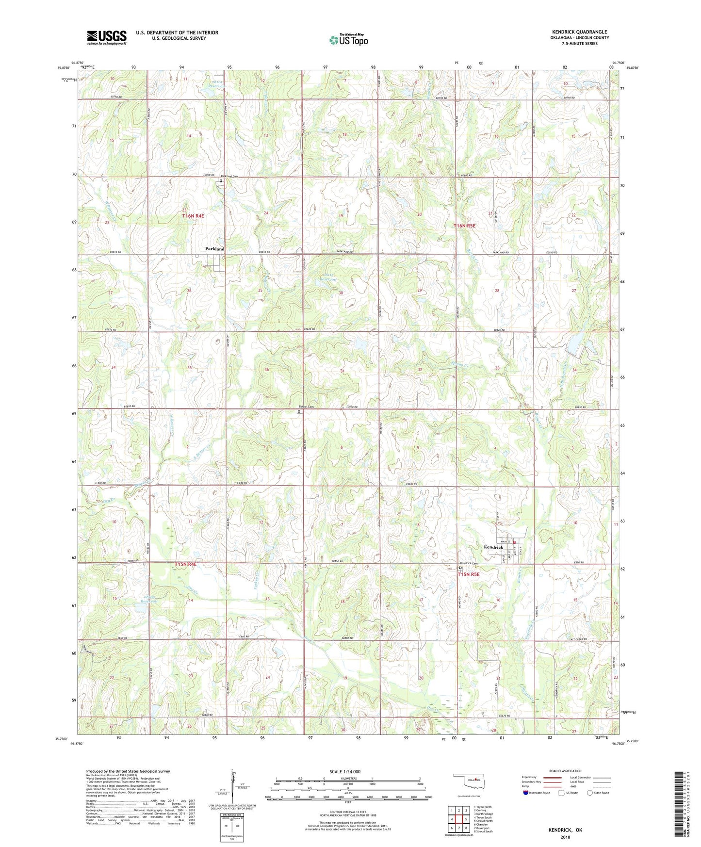
2022 topographic map quadrangle Kendrick in the state of Oklahoma. Scale: 1:24000. Based on the newly updated USGS 7.5' US Topo map series, this map is in the following counties: Lincoln. The map contains contour data, water features, and other items you are used to seeing on USGS maps, but also has updated roads and other features. This is the next generation of topographic maps. Printed on high-quality waterproof paper with UV fade-resistant inks.
Quads adjacent to this one:
West: Tryon South
Northwest: Tryon North
North: Cushing
Northeast: North Village
East: Stroud North
Southeast: Stroud South
South: Davenport
Southwest: Chandler
This map covers the same area as the classic USGS quad with code o35096g7.
Contains the following named places: Beaver Creek, Bethel Greenwood Cemetery, East Beaver Creek, Fourmile Creek, Grass Strip, Kendrick, Kendrick Cemetery, Kendrick Volunteer Fire Department, North Branch Ranch Creek, Oknoname 08105 Dam, Oknoname 08105 Reservoir, Oknoname 08114 Dam, Oknoname 08114 Reservoir, Oknoname 08115 Dam, Oknoname 08115 Reservoir, Parkland, Parkland Cemetery, Spring Creek, Town of Kendrick, Township of North Fox, Turkey Creek, West Beaver Creek