MyTopo
Sparks Oklahoma US Topo Map
Couldn't load pickup availability
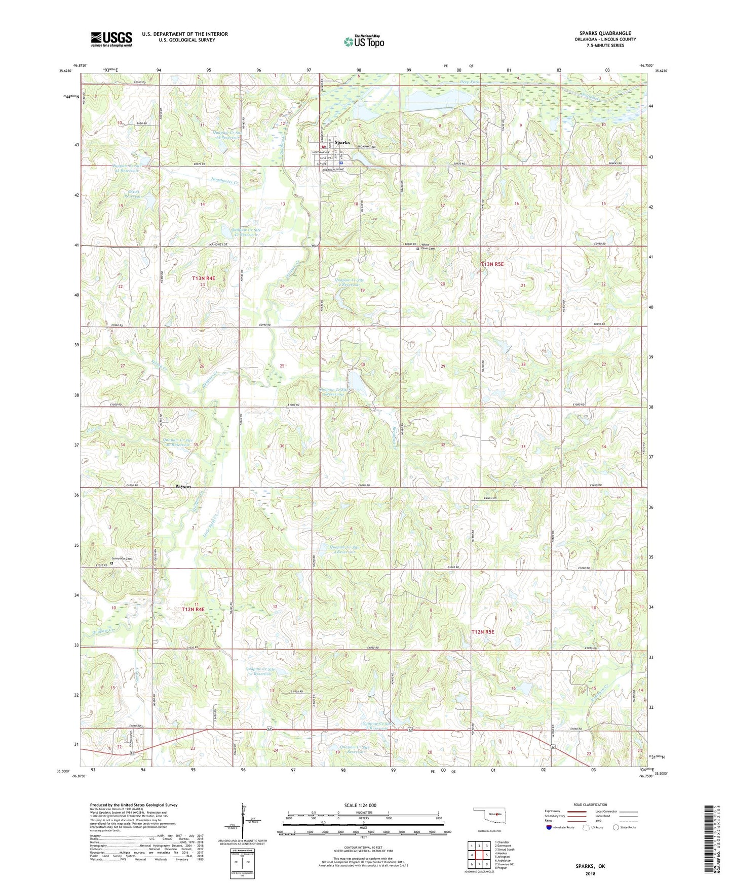
2022 topographic map quadrangle Sparks in the state of Oklahoma. Scale: 1:24000. Based on the newly updated USGS 7.5' US Topo map series, this map is in the following counties: Lincoln. The map contains contour data, water features, and other items you are used to seeing on USGS maps, but also has updated roads and other features. This is the next generation of topographic maps. Printed on high-quality waterproof paper with UV fade-resistant inks.
Quads adjacent to this one:
West: Meeker
Northwest: Chandler
North: Davenport
Northeast: Stroud South
East: Arlington
Southeast: Prague
South: Shawnee NE
Southwest: Aydelotte
This map covers the same area as the classic USGS quad with code o35096e7.
Contains the following named places: Breakfast Creek, Clear Creek, First Baptist Church, Hogshooter Creek, Little Sand Creek, Oknoname 08103 Dam, Oknoname 08103 Reservoir, Payson, Quapaw Creek Site 1 Dam, Quapaw Creek Site 1 Reservoir, Quapaw Creek Site 2 Dam, Quapaw Creek Site 2 Reservoir, Quapaw Creek Site 3 Dam, Quapaw Creek Site 3 Reservoir, Quapaw Creek Site 4 Dam, Quapaw Creek Site 4 Reservoir, Quapaw Creek Site 40 Dam, Quapaw Creek Site 40 Reservoir, Quapaw Creek Site 42 Dam, Quapaw Creek Site 42 Reservoir, Quapaw Creek Site 43 Dam, Quapaw Creek Site 43 Reservoir, Quapaw Creek Site 44 Dam, Quapaw Creek Site 44 Reservoir, Quapaw Creek Site 5c Dam, Quapaw Creek Site 5c Reservoir, Quapaw Creek Site 6 Dam, Quapaw Creek Site 6 Reservoir, Quapaw Creek Site 7 Dam, Quapaw Creek Site 7 Reservoir, Sand Creek, Spark Fire Department, Sparks, Sparks Police Department, Sparks Post Office, Spring Branch Church, Spring Creek, Sunnyside Cemetery, Town of Sparks, Township of South Seminole, Township of Sparks, White Dove Cemetery, ZIP Code: 74869