MyTopo
Ti Oklahoma US Topo Map
Couldn't load pickup availability
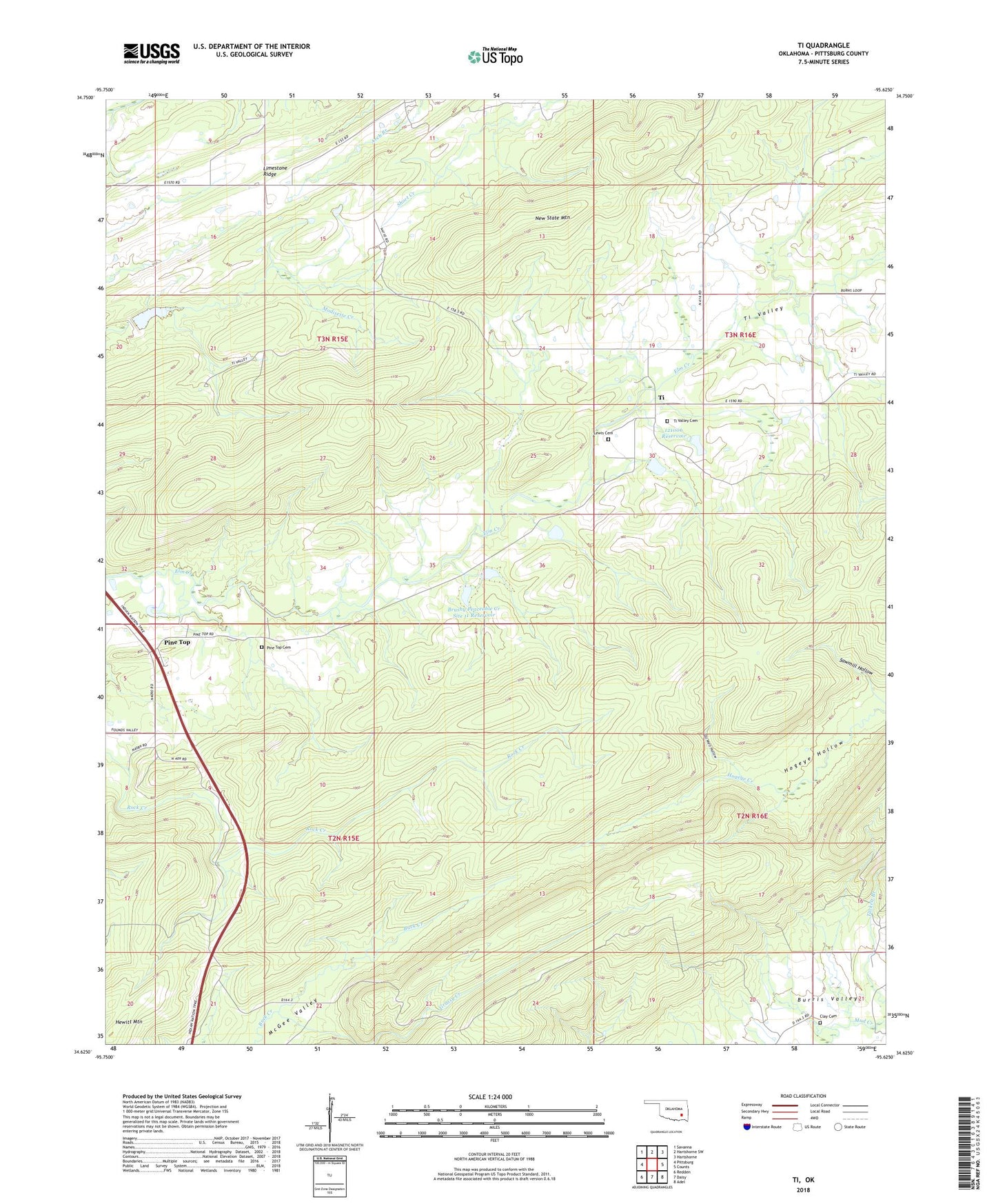
2018 topographic map quadrangle Ti in the state of Oklahoma. Scale: 1:24000. Based on the newly updated USGS 7.5' US Topo map series, this map is in the following counties: Pittsburg. The map contains contour data, water features, and other items you are used to seeing on USGS maps, but also has updated roads and other features. This is the next generation of topographic maps. Printed on high-quality waterproof paper with UV fade-resistant inks.
Quads adjacent to this one:
West: Pittsburg
Northwest: Savanna
North: Hartshorne SW
Northeast: Hartshorne
East: Counts
Southeast: Adel
South: Daisy
Southwest: Redden
Contains the following named places: Brushy Peaceable Creek Site 10 Dam, Brushy Peaceable Creek Site 10 Reservoir, Brushy Peaceable Creek Site 11 Dam, Brushy Peaceable Creek Site 11 Reservoir, Brushy Peaceable Creek Site 9 Dam, Brushy Peaceable Creek Site 9 Reservoir, Clay Cemetery, Grassy Creek, Lewis Cemetery, North Fork Elm Creek, Oil Well Hollow, Oknoname 121006 Dam, Oknoname 121006 Reservoir, Pine Top, Pine Top Cemetery, South Fork Elm Creek, Ti, Ti Valley, Ti Valley Cemetery, Township of Ti, ZIP Code: 74528