MyTopo
Long Mountain Oklahoma US Topo Map
Couldn't load pickup availability
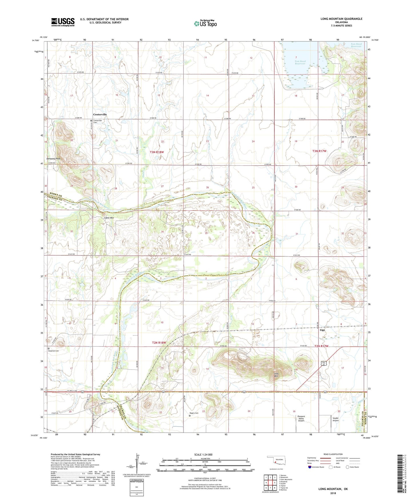
2022 topographic map quadrangle Long Mountain in the state of Oklahoma. Scale: 1:24000. Based on the newly updated USGS 7.5' US Topo map series, this map is in the following counties: Kiowa, Jackson, Tillman. The map contains contour data, water features, and other items you are used to seeing on USGS maps, but also has updated roads and other features. This is the next generation of topographic maps. Printed on high-quality waterproof paper with UV fade-resistant inks.
Quads adjacent to this one:
West: Headrick
Northwest: Warren
North: Roosevelt
Northeast: Glen Mountains
East: Snyder
Southeast: Manitou
South: Tipton SE
Southwest: Tipton
This map covers the same area as the classic USGS quad with code o34099f1.
Contains the following named places: Cable Mountain, Centerville, Centerville Cemetery, Dempsey Peak, East Dike Dam, Headrick Cemetery, Kickapoo Sandy Creek Site K2 Dam, Kickapoo Sandy Creek Site K2 Reservoir, Kickapoo Sandy Creek Site K3 Dam, Kickapoo Sandy Creek Site K3 Reservoir, Kickapoo Sandy Creek Site K6 Dam, Kickapoo Sandy Creek Site K6 Reservoir, Lige, Long Mountain, Oknoname 07005 Reservoir, Oknoname 075005 Dam, Oknoname 075006 Dam, Oknoname 075006 Reservoir, Owl Creek, Rogers Cemetery, Snyder Airport, West Dike Dam