MyTopo
Turner Falls Oklahoma US Topo Map
Couldn't load pickup availability
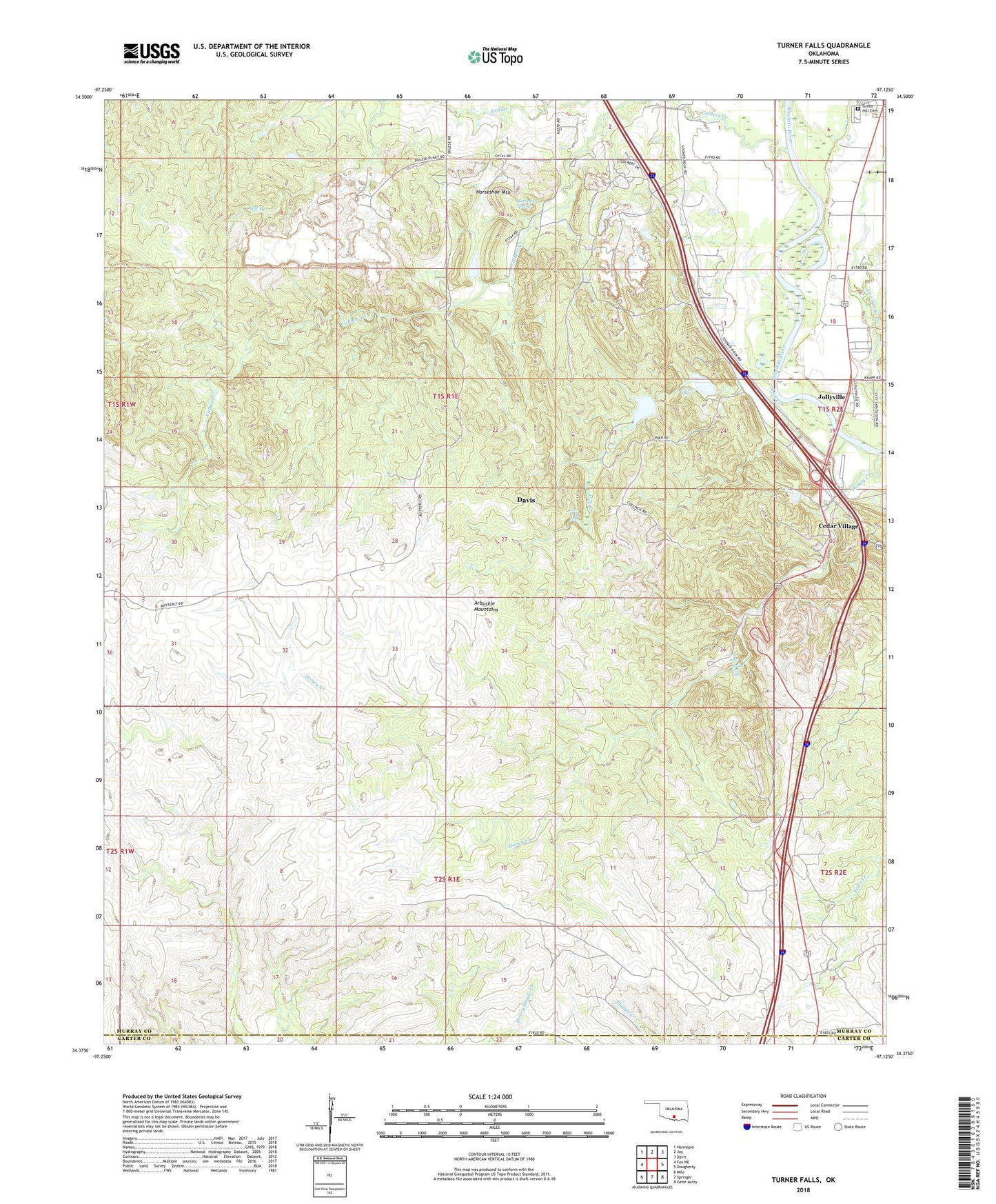
2018 topographic map quadrangle Turner Falls in the state of Oklahoma. Scale: 1:24000. Based on the newly updated USGS 7.5' US Topo map series, this map is in the following counties: Murray, Carter. The map contains contour data, water features, and other items you are used to seeing on USGS maps, but also has updated roads and other features. This is the next generation of topographic maps. Printed on high-quality waterproof paper with UV fade-resistant inks.
Quads adjacent to this one:
West: Fox NE
Northwest: Hennepin
North: Joy
Northeast: Davis
East: Dougherty
Southeast: Gene Autry
South: Springer
Southwest: Milo
Contains the following named places: Arbuckle Mountains, Bridal Veil Falls, Camp Classen, Cedar Village, City of Davis, Classen Falls, Green Hill Cemetery, Horseshoe Creek, Horseshoe Mountain, Horseshoe Spring, Jollyville, Lick Creek, Lick Creek Falls, Nazarene Camp, Township of Turner, Turner Falls, Turner Falls Park, West Murray Division, YMCA Camp Classen Number 1 Dam, YMCA Camp Classen Number 1 Reservoir, YMCA Camp Classen Number 2 Dam, YMCA Camp Classen Number 2 Reservoir, Youth Camp, ZIP Code: 73030