MyTopo
Verden Oklahoma US Topo Map
Couldn't load pickup availability
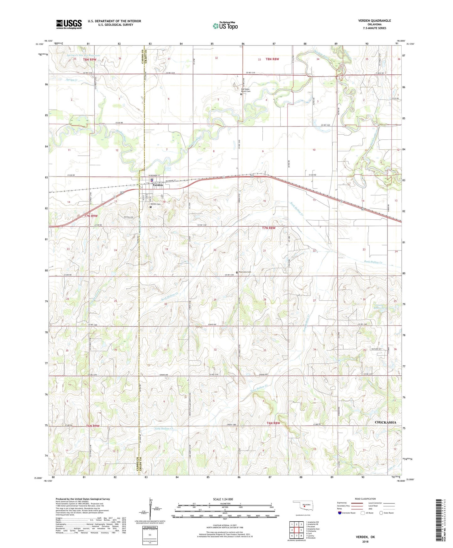
2018 topographic map quadrangle Verden in the state of Oklahoma. Scale: 1:24000. Based on the newly updated USGS 7.5' US Topo map series, this map is in the following counties: Grady, Caddo. The map contains contour data, water features, and other items you are used to seeing on USGS maps, but also has updated roads and other features. This is the next generation of topographic maps. Printed on high-quality waterproof paper with UV fade-resistant inks.
Quads adjacent to this one:
West: Anadarko East
Northwest: Anadarko NW
North: Anadarko NE
Northeast: Pocasset
East: Chickasha
Southeast: Ninnekah
South: Laverty
Southwest: Cyril
Contains the following named places: County Line Creek, Elderberry Church, Faith Baptist Church, Half Moon Ranch Cemetery, Ionine Creek, Mennonite Church, Oknoname 051032 Dam, Oknoname 051032 Reservoir, Plainview Cemetery, Spring Creek, Spring Creek Site 103 Dam, Spring Creek Site 103 Reservoir, Tony Hollow Creek, Town of Verden, Township of Shirley, United Methodist Church, Verden, Verden Cemetery, Verden Elementary School, Verden High School, Verden Police Department, Verden Post Office, Verden Volunteer Fire Department, ZIP Code: 73092