MyTopo
Wister Oklahoma US Topo Map
Couldn't load pickup availability
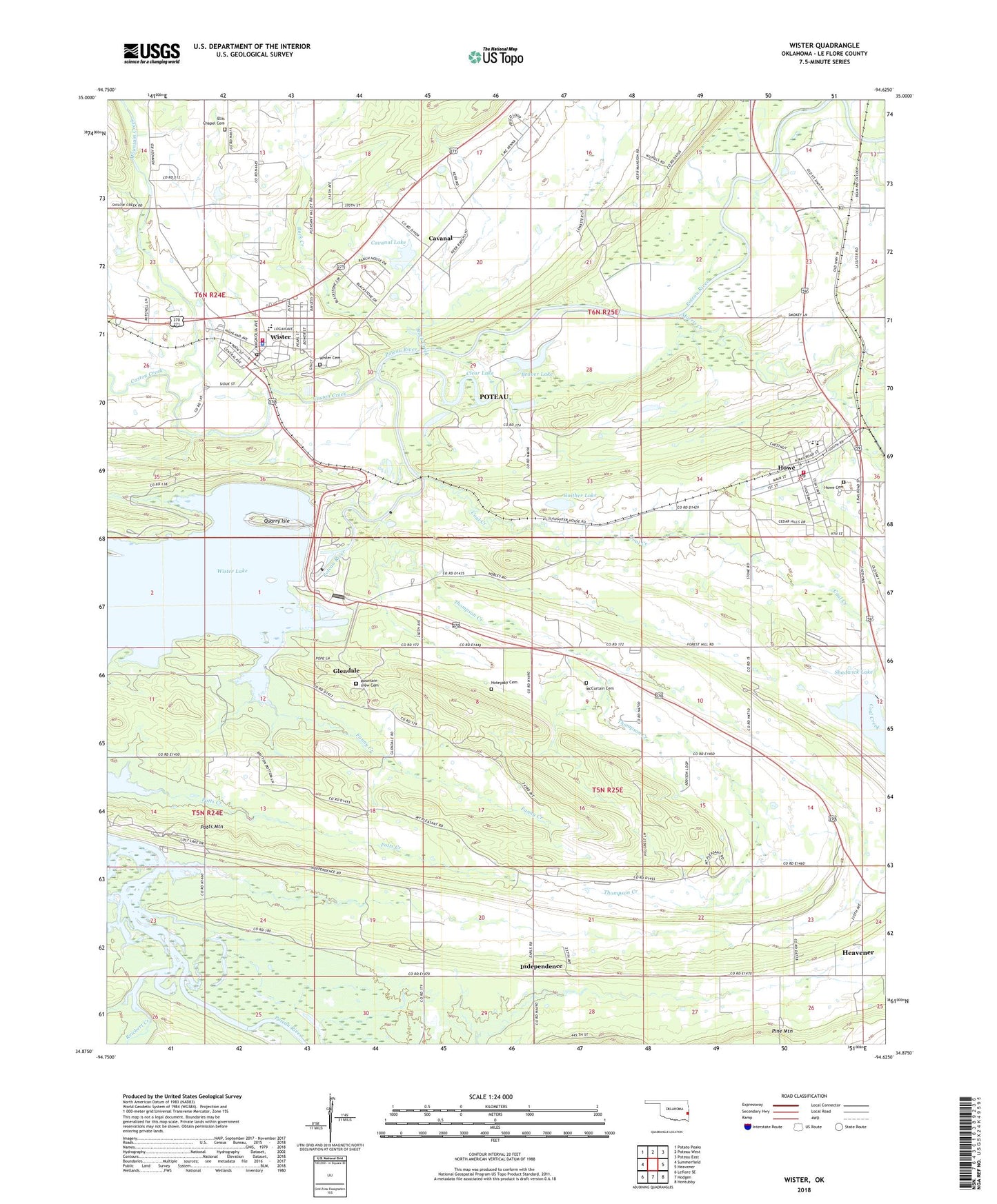
2018 topographic map quadrangle Wister in the state of Oklahoma. Scale: 1:24000. Based on the newly updated USGS 7.5' US Topo map series, this map is in the following counties: Le Flore. The map contains contour data, water features, and other items you are used to seeing on USGS maps, but also has updated roads and other features. This is the next generation of topographic maps. Printed on high-quality waterproof paper with UV fade-resistant inks.
Quads adjacent to this one:
West: Summerfield
Northwest: Potato Peaks
North: Poteau West
Northeast: Poteau East
East: Heavener
Southeast: Hontubby
South: Hodgen
Southwest: Leflore SE
Contains the following named places: Beaver Lake, Bethel Church, Calvary Church, Caston Creek, Cavanal, Cavanal Lake, Cavanal Lake Dam, Clear Lake, Coal Creek, Ellis Chapel, Ellis Chapel Cemetery, Faith Church, Fanny Creek, Gaither Lake, Gaither Lake Dam, Glendale, Hoteyaby Cemetery, Howe, Howe Cemetery, Howe Elementary School, Howe Fire Department, Howe High School, Howe Post Office, Independence, Independence Church, Le Flore County, McCurtain Cemetery, Morris Creek, Mount Pleasant Church, Mountain Creek, Mountain View Cemetery, Mountain View Church, Oknoname 079002 Dam, Oknoname 079002 Reservoir, Potts Creek, Potts Mountain, Quarry Isle, Reichert Creek, Rock Creek, Settlement, Shadwick Lake, Shadwick Lake Dam, Thompson Creek, Town of Howe, Town of Wister, Township of Howe, Victory Church, Wister, Wister Cemetery, Wister Dam, Wister Elementary School, Wister Fire Department, Wister High School, Wister Police Department, Wister Post Office, Wister State Park