MyTopo
Poteau West Oklahoma US Topo Map
Couldn't load pickup availability
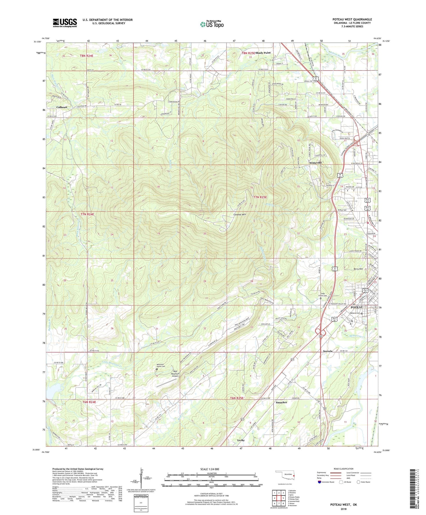
2022 topographic map quadrangle Poteau West in the state of Oklahoma. Scale: 1:24000. Based on the newly updated USGS 7.5' US Topo map series, this map is in the following counties: Le Flore. The map contains contour data, water features, and other items you are used to seeing on USGS maps, but also has updated roads and other features. This is the next generation of topographic maps. Printed on high-quality waterproof paper with UV fade-resistant inks.
Quads adjacent to this one:
West: Potato Peaks
Northwest: Bokoshe
North: Panama
Northeast: Spiro
East: Poteau East
Southeast: Heavener
South: Wister
Southwest: Summerfield
This map covers the same area as the classic USGS quad with code o35094a6.
Contains the following named places: Baldwin Branch, Calhoun, Calvary Assembly of God, Carl Albert State College, Caston Mountain Creek Site 5 Reservoir, Cavanal Mountain, Cedar Grove Cemetery, Choctaw Country Club, Country Square, County District 4, Emergency Medical Services of Le Flore County Station 6 Headquarters, First Assembly of God Church, First Pentecostal Church, Kiamichi Technology Center Poteau, KLCO, KPRV-AM (Poteau), KZBB-FM (Poteau), Long Lake, Mountain Home Cemetery, Oakland Cemetery, Pentecostal Church of God, Pleasant Valley Church, Poteau Fire Department Station 2, Poteau High School, Poteau Primary School, Poteau Upper Elementary School, Poteau Valley Baptist Church, River Valley Cosmetology Institute, Rock Creek, Saint Barnabas Episcopal Church, Simpson School, Smacker, Sorrels, Southside Baptist Church, Tarby School, Terrell Lake, Terry Hill, Township of Poteau, Twyman Park, Wal Mart Shopping Center, Witteville, Wolf Mountain Airport, Yerby