MyTopo
Poteau East Oklahoma US Topo Map
Couldn't load pickup availability
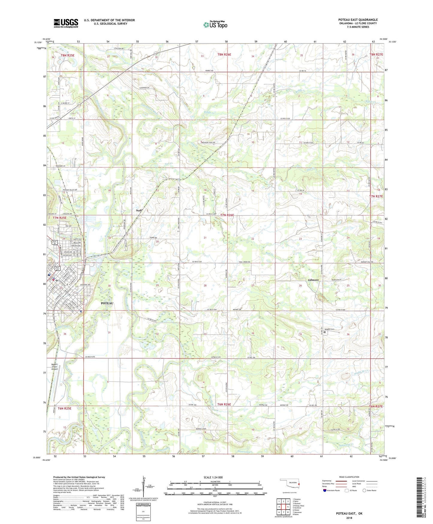
2022 topographic map quadrangle Poteau East in the state of Oklahoma. Scale: 1:24000. Based on the newly updated USGS 7.5' US Topo map series, this map is in the following counties: Le Flore. The map contains contour data, water features, and other items you are used to seeing on USGS maps, but also has updated roads and other features. This is the next generation of topographic maps. Printed on high-quality waterproof paper with UV fade-resistant inks.
Quads adjacent to this one:
West: Poteau West
Northwest: Panama
North: Spiro
Northeast: Hackett
East: Hartford
Southeast: Bates
South: Heavener
Southwest: Wister
This map covers the same area as the classic USGS quad with code o35094a5.
Contains the following named places: Cameron Division, Church of Christ, Church of the Nazarene, City of Poteau, Cowskin Creek, Double Branch Church, Double Branch Creek, Eastern Oklahoma Medical Center, First Baptist Church, First Christian Church, First United Methodist Church, Gilmore, Kingdom Hall Jehovahs Witnesses, Le Flore County Detention Center, Le Flore County Sheriff's Office, Lost Poteau River, McMurtrey Creek, Nail Creek, Neff, Pansy Kidd Middle School, Polk Creek, Poteau, Poteau Division, Poteau Fire Department Station 1 Headquarters, Poteau Police Department, Poteau Post Office, Presbyterian Church, Reorganized Church of Jesus Christ of Latter Day Saints, Riddle Creek, Robert S Kerr Airport, Rodman School, The Church of Jesus Christ of Latter Day Saints, The Cutoff, Town Creek, Township of Kully Chaha, Vaughn Cemetery, ZIP Code: 74953