
MyTopo
Alsea Oregon US Topo Map
Couldn't load pickup availability
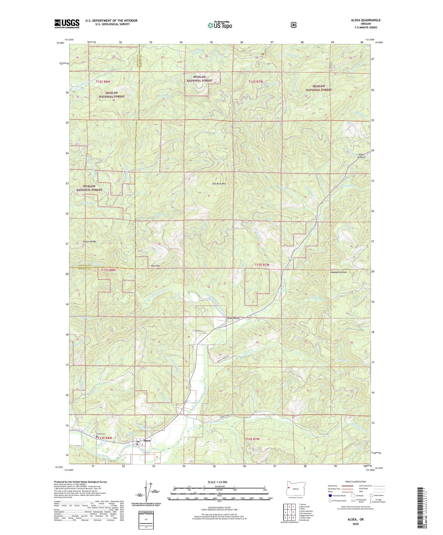
2020 topographic map quadrangle Alsea in the state of Oregon. Scale: 1:24000. Based on the newly updated USGS 7.5' US Topo map series, this map is in the following counties: Benton, Lincoln. The map contains contour data, water features, and other items you are used to seeing on USGS maps, but also has updated roads and other features. This is the next generation of topographic maps. Printed on high-quality waterproof paper with UV fade-resistant inks.
Quads adjacent to this one:
West: Grass Mountain
Northwest: Harlan
North: Marys Peak
Northeast: Wren
East: Flat Mountain
Southeast: Glenbrook
South: Prairie Peak
Southwest: Digger Mountain
Contains the following named places: Ahsney Creek, Alder Creek, Alsea, Alsea Cemetery, Alsea Census Designated Place, Alsea Community Library, Alsea County Service District, Alsea Elementary School, Alsea Guard Station, Alsea High School, Alsea Mountain Roadside Rest Area, Alsea Post Office, Alsea Ranger Station, Alsea River Hatchery, Alsea Rural Fire Protection District, Alsea Summit, Alsea United Methodist Church, Arnold Creek, Bailey Creek, Baker Creek, Beaty Creek, Cabin Creek, Cathcart Creek, Cathcart Springs, Chittam Creek, Clemens County Park, Connors Camp Recreation Site, Crooked Creek, Doe Mountain, Easter Creek, Ernest Creek, Gravel Creek, Hayden Creek, Honey Grove Creek, Kiger Creek, Lake Ridge, Little Alder Creek, Lo wa' ha yu Creek, Maddsens Knob, Marys Wayside Recreation Site, Mill Creek, North Fork Alsea River, Old Blue Mountain, Parker Creek, Pa'wint Creek, Roberts Creek, Ryder Creek, Salmon Creek, Seeley Creek, Slide Creek, South Fork Alsea River, Southwest Benton Division, Wusi'n Creek, Yew Creek, Zahn Creek


