MyTopo
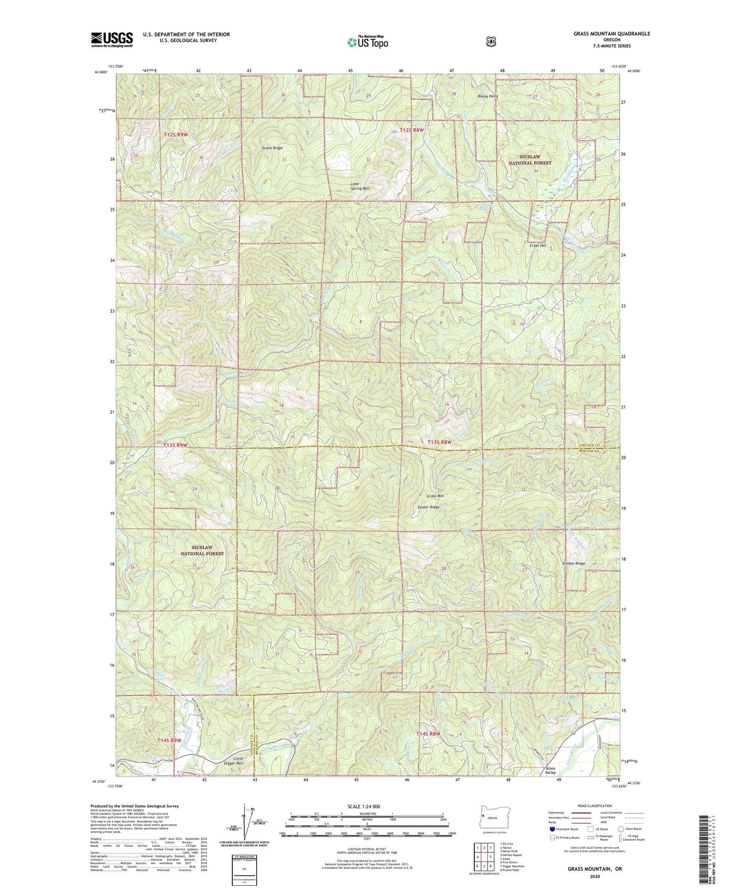
Grass Mountain Oregon US Topo Map
Couldn't load pickup availability
Also explore the Grass Mountain Forest Service Topo of this same quad for updated USFS data
2024 topographic map quadrangle Grass Mountain in the state of Oregon. Scale: 1:24000. Based on the newly updated USGS 7.5' US Topo map series, this map is in the following counties: Lincoln, Benton. The map contains contour data, water features, and other items you are used to seeing on USGS maps, but also has updated roads and other features. This is the next generation of topographic maps. Printed on high-quality waterproof paper with UV fade-resistant inks.
Quads adjacent to this one:
West: Hellion Rapids
Northwest: Elk City
North: Harlan
Northeast: Marys Peak
East: Alsea
Southeast: Prairie Peak
South: Digger Mountain
Southwest: Five Rivers
This map covers the same area as the classic USGS quad with code o44123d6.
Contains the following named places: Angora Post Office, Bear Creek, Bull Run Creek, Cove Creek, Creel Hill, Digger Creek, Easter Ridge, Fall Creek, Fall Creek Falls, Grant Ridge, Grass Mountain, Green Ridge, Hatchery Creek, Horse Creek, Kimble Ridge, Kimble Ridge Creek, Klickitat Creek, Klickitat Lake, Lake Creek, Lake Ridge Creek, Lone Spring Mountain, Mason Creek, Mill Creek Boat Landing, Mill Creek County Park, North Fork Mill Creek, Racks Creek, Rocky Point, Sharp Ranch, Skunk Creek, Slate Creek, Stiltner Creek, Sweethome Creek, Thissell Pond, West Fork Mill Creek