MyTopo
Glenbrook Oregon US Topo Map
Couldn't load pickup availability
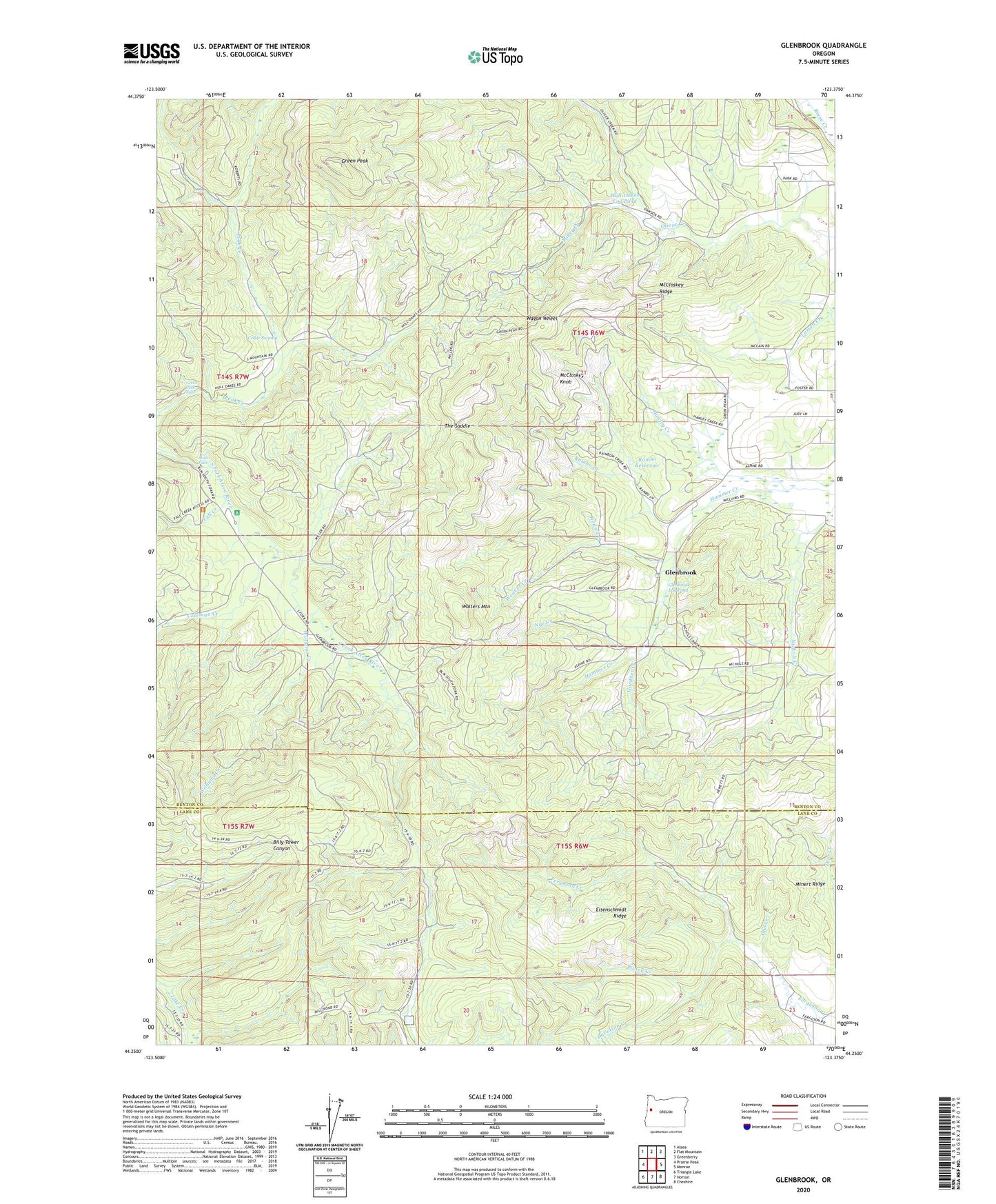
2023 topographic map quadrangle Glenbrook in the state of Oregon. Scale: 1:24000. Based on the newly updated USGS 7.5' US Topo map series, this map is in the following counties: Benton, Lane. The map contains contour data, water features, and other items you are used to seeing on USGS maps, but also has updated roads and other features. This is the next generation of topographic maps. Printed on high-quality waterproof paper with UV fade-resistant inks.
Quads adjacent to this one:
West: Prairie Peak
Northwest: Alsea
North: Flat Mountain
Northeast: Greenberry
East: Monroe
Southeast: Cheshire
South: Horton
Southwest: Triangle Lake
This map covers the same area as the classic USGS quad with code o44123c4.
Contains the following named places: Alsea Falls, Alsea Falls Recreation Site, Bellfountain County Park, Cebu, Cedar Swamp, Coleman Creek, Davidson Creek, Dawson, Eisenschmidt Ridge, Fall Creek, Gardner Creek, Glenbrook, Glenbrook Log Pond, Glenbrook Post Office, Green Peak, Green Peak Falls, Howell Creek, Hull-Oakes Log Pond, Jacksons Mill, McCloskey Knob, McCloskey Ridge, McCready, Miller Creek, Minert Ridge, Munsey, Nye Creek, Owl Creek, Pitney Creek, Rambo Creek, Rambo Reservoir, Sims, Skinner, The Saddle, Wagon Wheel, Walters Mountain, Weaver Creek, Williams Creek