MyTopo
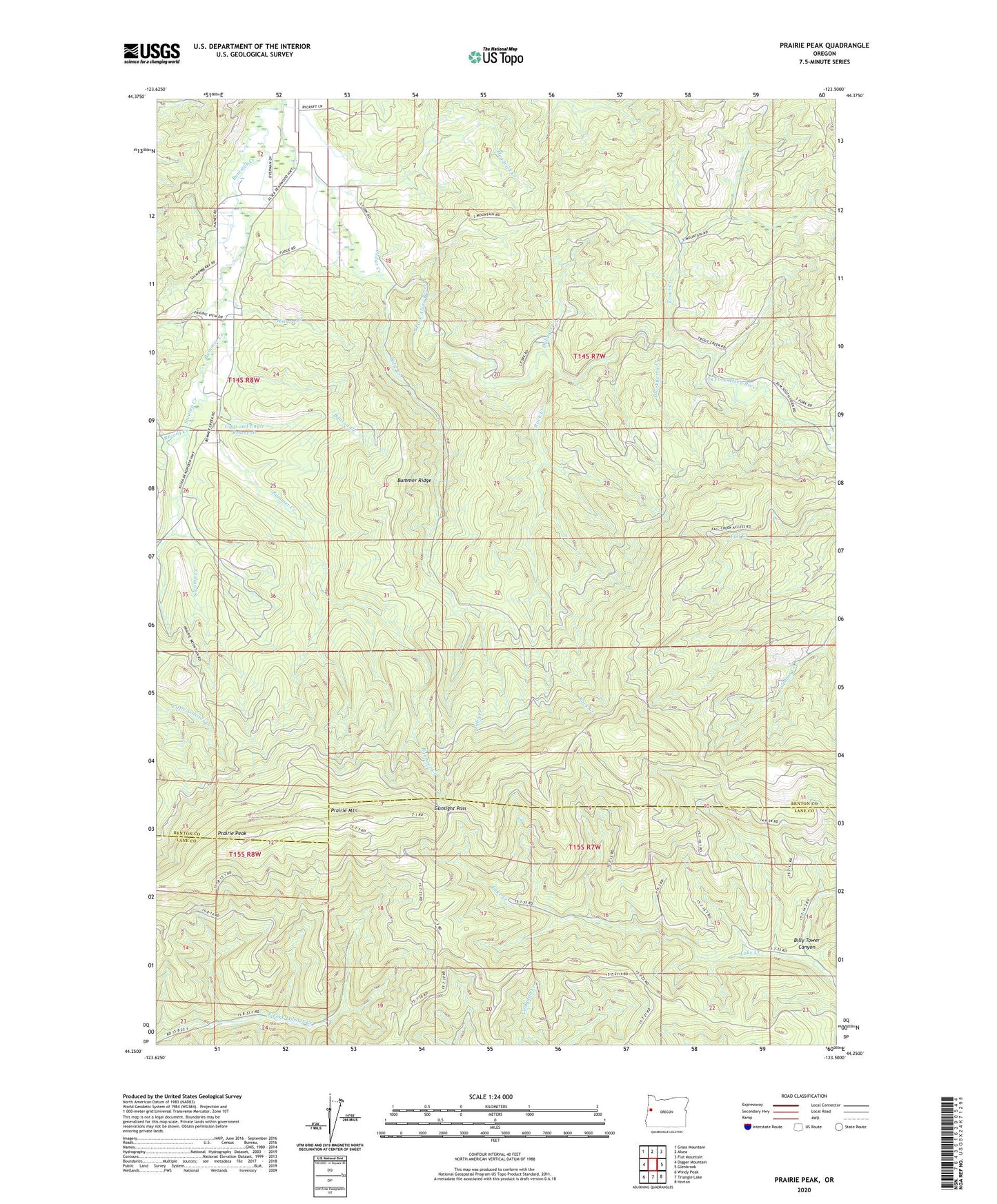
Prairie Peak Oregon US Topo Map
Couldn't load pickup availability
Also explore the Prairie Peak Forest Service Topo of this same quad for updated USFS data
2023 topographic map quadrangle Prairie Peak in the state of Oregon. Scale: 1:24000. Based on the newly updated USGS 7.5' US Topo map series, this map is in the following counties: Benton, Lane. The map contains contour data, water features, and other items you are used to seeing on USGS maps, but also has updated roads and other features. This is the next generation of topographic maps. Printed on high-quality waterproof paper with UV fade-resistant inks.
Quads adjacent to this one:
West: Digger Mountain
Northwest: Grass Mountain
North: Alsea
Northeast: Flat Mountain
East: Glenbrook
Southeast: Horton
South: Triangle Lake
Southwest: Windy Peak
This map covers the same area as the classic USGS quad with code o44123c5.
Contains the following named places: Banton Creek, Billy Tower Canyon, Blackberry Creek, Brown Creek, Bummer Creek, Bummer Ridge, Cedar Creek, Dubuque Creek, Gunsight Pass, Gygi and Engle Reservoir, Headrick Creek, KMTB-FM, Peak Creek, Prairie Mountain, Prairie Peak, Record Creek, Rock Creek, Swamp Creek, Tobe Creek, Trout Creek, Wilson Creek, ZIP Code: 97324