MyTopo
Alvord Hot Springs Oregon US Topo Map
Couldn't load pickup availability
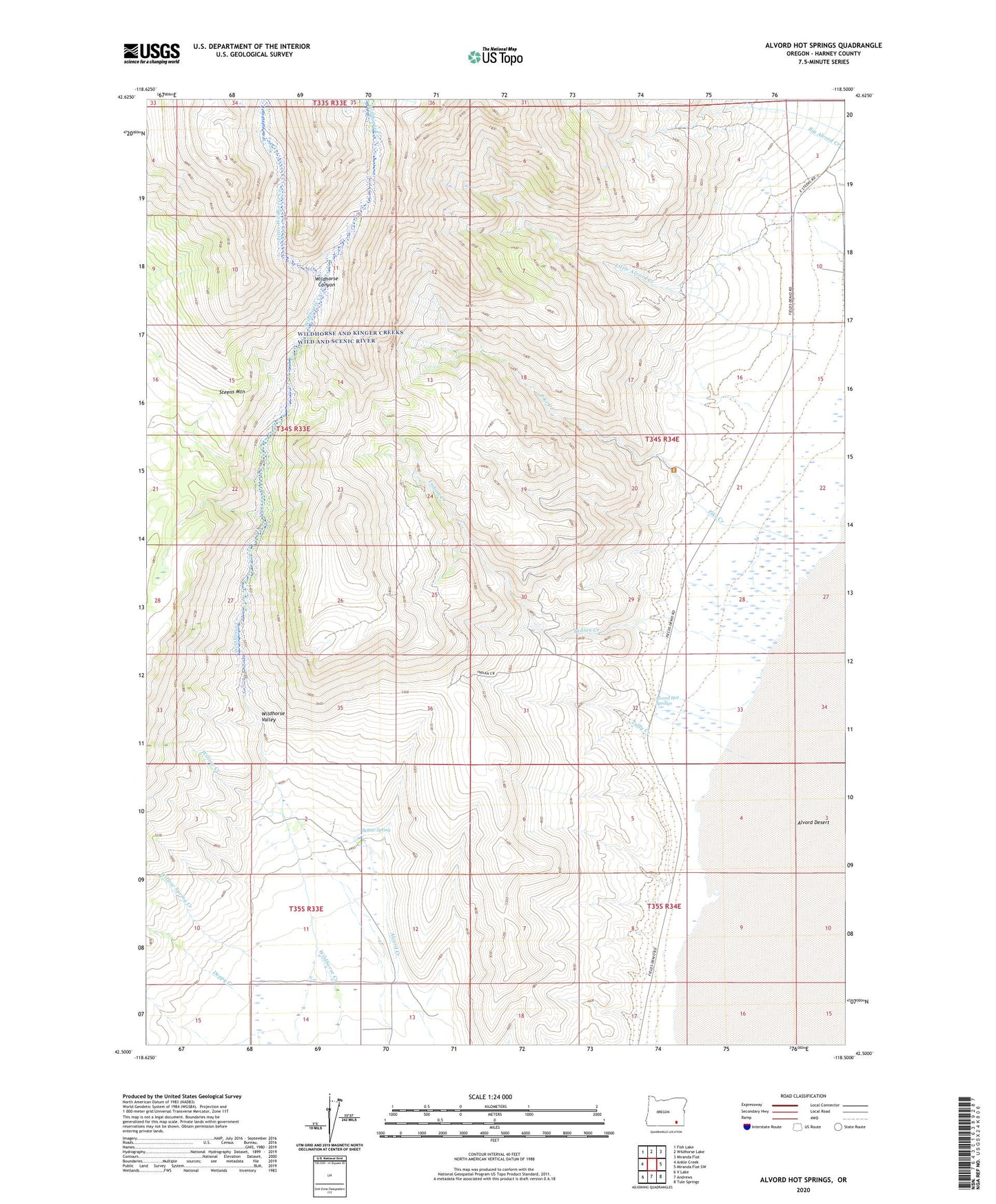
2023 topographic map quadrangle Alvord Hot Springs in the state of Oregon. Scale: 1:24000. Based on the newly updated USGS 7.5' US Topo map series, this map is in the following counties: Harney. The map contains contour data, water features, and other items you are used to seeing on USGS maps, but also has updated roads and other features. This is the next generation of topographic maps. Printed on high-quality waterproof paper with UV fade-resistant inks.
Quads adjacent to this one:
West: Ankle Creek
Northwest: Fish Lake
North: Wildhorse Lake
Northeast: Miranda Flat
East: Miranda Flat SW
Southeast: Tule Springs
South: Andrews
Southwest: V Lake
This map covers the same area as the classic USGS quad with code o42118e5.
Contains the following named places: Alexander Mine, Alvord Hot Springs, Belzar Spring, Carlson Ranch, Deppy Creek, Deppy Ranch, Dry Creek, Indian Creek, Kriska Mine, Little Alvord Well, Little Wildhorse Creek, Pike Creek, Stonehouse Creek, Tuffy Creek, Western Quartz Mine, Wildhorse and Kinger Creeks Wild and Scenic River, Wildhorse Canyon, Willow Creek, Willow Spring Creek