MyTopo
Arch Cape Oregon US Topo Map
Couldn't load pickup availability
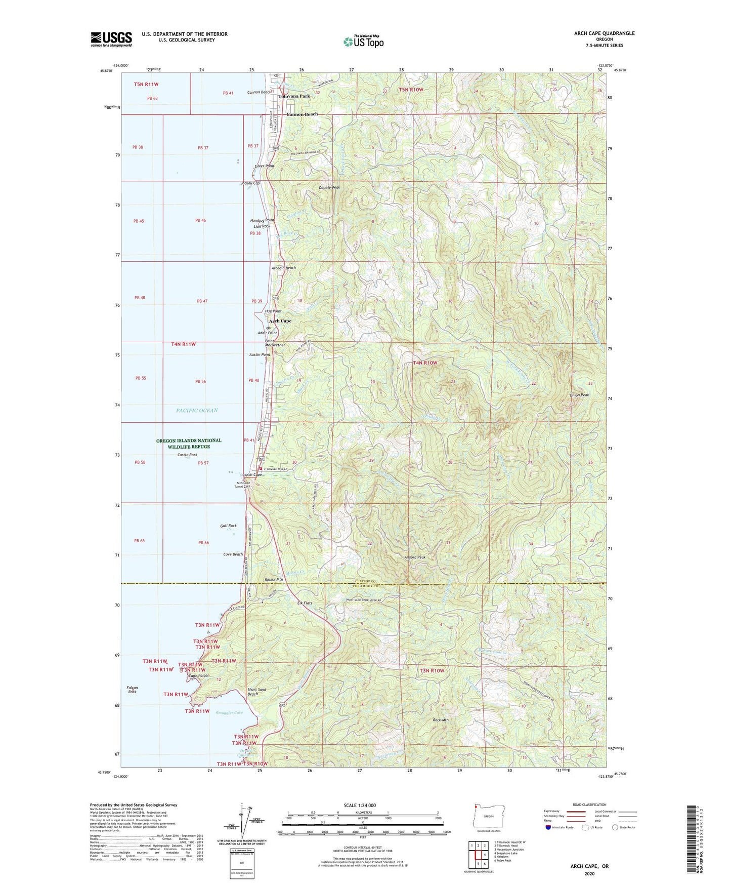
2024 topographic map quadrangle Arch Cape in the state of Oregon. Scale: 1:24000. Based on the newly updated USGS 7.5' US Topo map series, this map is in the following counties: Clatsop, Tillamook. The map contains contour data, water features, and other items you are used to seeing on USGS maps, but also has updated roads and other features. This is the next generation of topographic maps. Printed on high-quality waterproof paper with UV fade-resistant inks.
Quads adjacent to this one:
Northwest: Tillamook Head OE W
North: Tillamook Head
Northeast: Necanicum Junction
East: Soapstone Lake
Southeast: Foley Peak
South: Nehalem
This map covers the same area as the classic USGS quad with code o45123g8.
Contains the following named places: Adair Point, Angora Peak, Arcadia Beach, Arcadia Beach State Park, Arch Cape, Arch Cape Creek, Arch Cape Post Office, Arch Cape Tunnel 2247, Arch Cape Water and Sanitary District, Armstead Memorial, Asbury Creek, Austin Creek, Austin Point, Cannon Beach Post Office, Cannon Beach Rural Fire Protection District Arch Cape Station, Cape Falcon, Castle Rock, Cedar Creek, Chisana Creek, Clayton Creek, Cove Beach, Devils Cauldron, Dila Dairy, Double Peak, Elk Flats, Falcon Rock, Fall Creek, Fire Mountain School, Griffin Creek, Gull Rock, Hug Creek, Hug Point, Hug Point State Park, Humbug Point, Jockey Cap, Lion Rock, Mason Creek, Necarney Creek, Nehalem Harwood Square, Onion Peak, Oswald West State Park, Point Meriwether, Red Rock Creek, Rock Mountain, Round Mountain, Shark Creek, Short Sand Beach, Short Sand Creek, Silver Point, Smuggler Cove, Tolovana Beach State Park, Tolovana Park, Tolovana Park Post Office, Treasure Cove, ZIP Codes: 97102, 97145