MyTopo
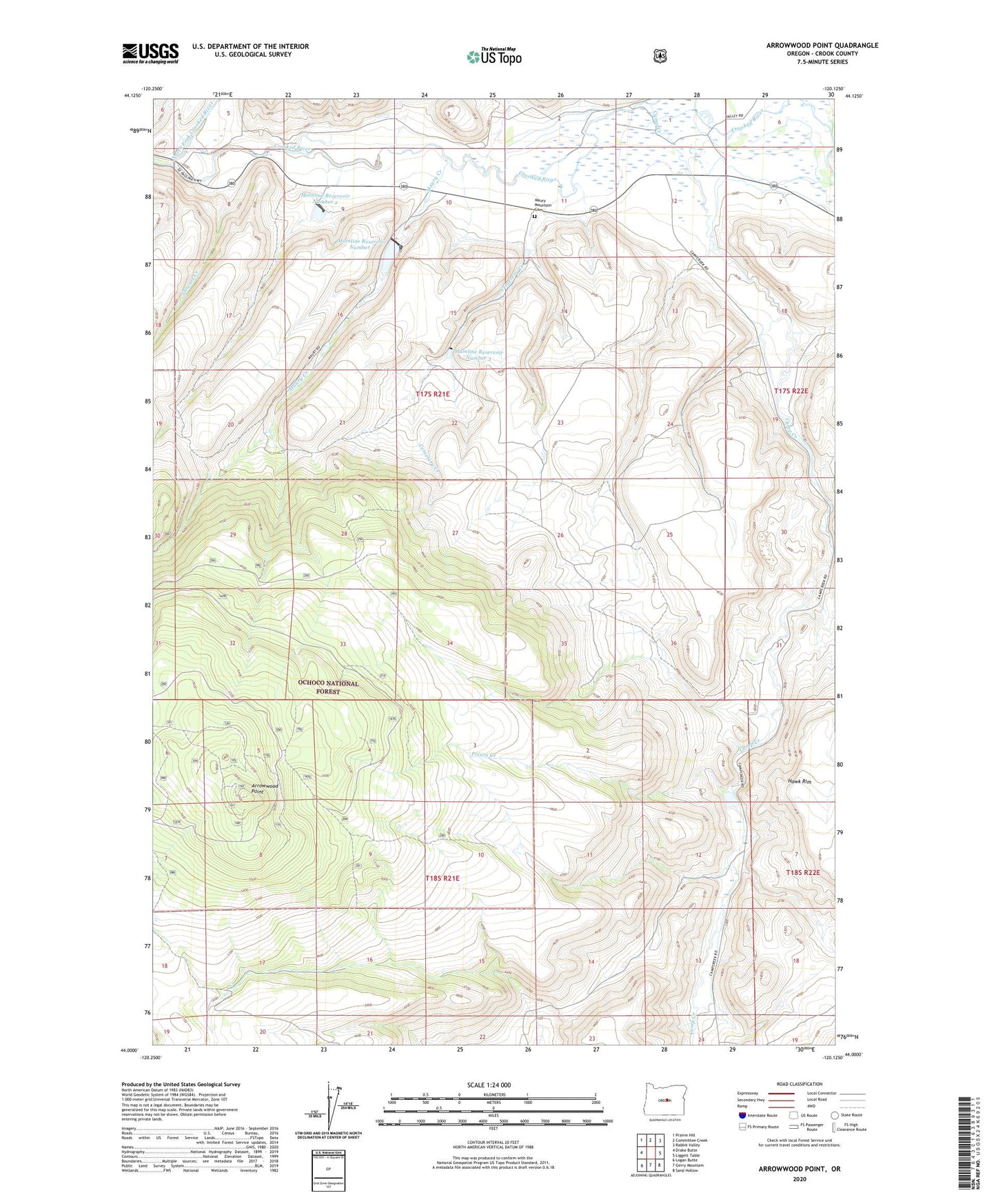
Arrowwood Point Oregon US Topo Map
Couldn't load pickup availability
Also explore the Arrowwood Point Forest Service Topo of this same quad for updated USFS data
2023 topographic map quadrangle Arrowwood Point in the state of Oregon. Scale: 1:24000. Based on the newly updated USGS 7.5' US Topo map series, this map is in the following counties: Crook. The map contains contour data, water features, and other items you are used to seeing on USGS maps, but also has updated roads and other features. This is the next generation of topographic maps. Printed on high-quality waterproof paper with UV fade-resistant inks.
Quads adjacent to this one:
West: Drake Butte
Northwest: Prairie Hill
North: Committee Creek
Northeast: Rabbit Valley
East: Liggett Table
Southeast: Sand Hollow
South: Gerry Mountain
Southwest: Logan Butte
This map covers the same area as the classic USGS quad with code o44120a2.
Contains the following named places: Arrow Wood Camp, Arrowwood Point, Camp Creek, Camp Maury, Cemetery Canyon, Cemetery Creek, Cemetery Ridge, Crooked River Division, Culver Ridge, Glenn Ranch, Gone Creek, Grassy Butte, Hawley Ridge, Mainline Dam Number 1, Mainline Dam Number 2, Mainline Dam Number 3, Mainline Reservoir Number 1, Mainline Reservoir Number 2, Mainline Reservoir Number 3, Maury Creek, Maury Mountain Cemetery, Morgan Gulch, Mowry Post Office, North Fork Crooked River, Poison Creek, Severance Ranch, Stewart Creek, Vanderburg Canyon, Wagon Butte