MyTopo
Drake Butte Oregon US Topo Map
Couldn't load pickup availability
Also explore the Drake Butte Forest Service Topo of this same quad for updated USFS data
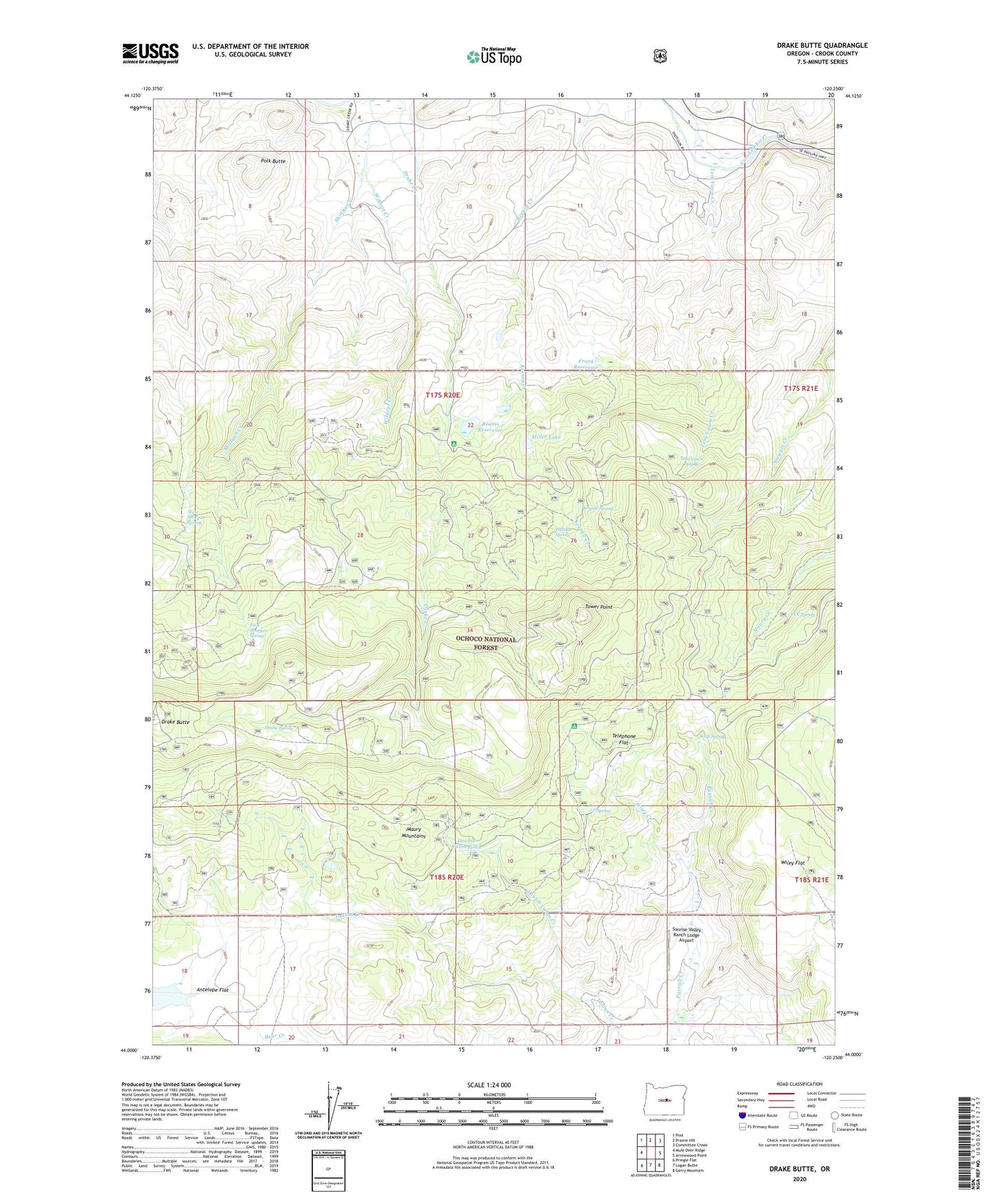
2023 topographic map quadrangle Drake Butte in the state of Oregon. Scale: 1:24000. Based on the newly updated USGS 7.5' US Topo map series, this map is in the following counties: Crook. The map contains contour data, water features, and other items you are used to seeing on USGS maps, but also has updated roads and other features. This is the next generation of topographic maps. Printed on high-quality waterproof paper with UV fade-resistant inks.
Quads adjacent to this one:
West: Mule Deer Ridge
Northwest: Post
North: Prairie Hill
Northeast: Committee Creek
East: Arrowwood Point
Southeast: Gerry Mountain
South: Logan Butte
Southwest: Pringle Flat
This map covers the same area as the classic USGS quad with code o44120a3.
Contains the following named places: Antelope Flat, CCC Spring, Coyote Spring, Double Cabin Creek, Double Cabin Pond, Double Cabin Recreation Site, Drake Creek, Drake Spring, East Shotgun Spring, Elkhorn Recreation Site, Frank Reservoir, Hillside Spring, Houston Ranch, J F Spring, Maury Guard Station, Miller Lake, Peterson Reservoir, Polk Butte, Reams Reservoir, Shotgun Creek, Soap Spring, Sunrise Valley Ranch Lodge Airport, Telephone Flat, Tom Vawn Creek, Tom Vawn Spring, Tower Point, West Shotgun Spring, Wildcat Creek, Wiley Creek, Wiley Flat, Wiley Flat Recreation Site