MyTopo
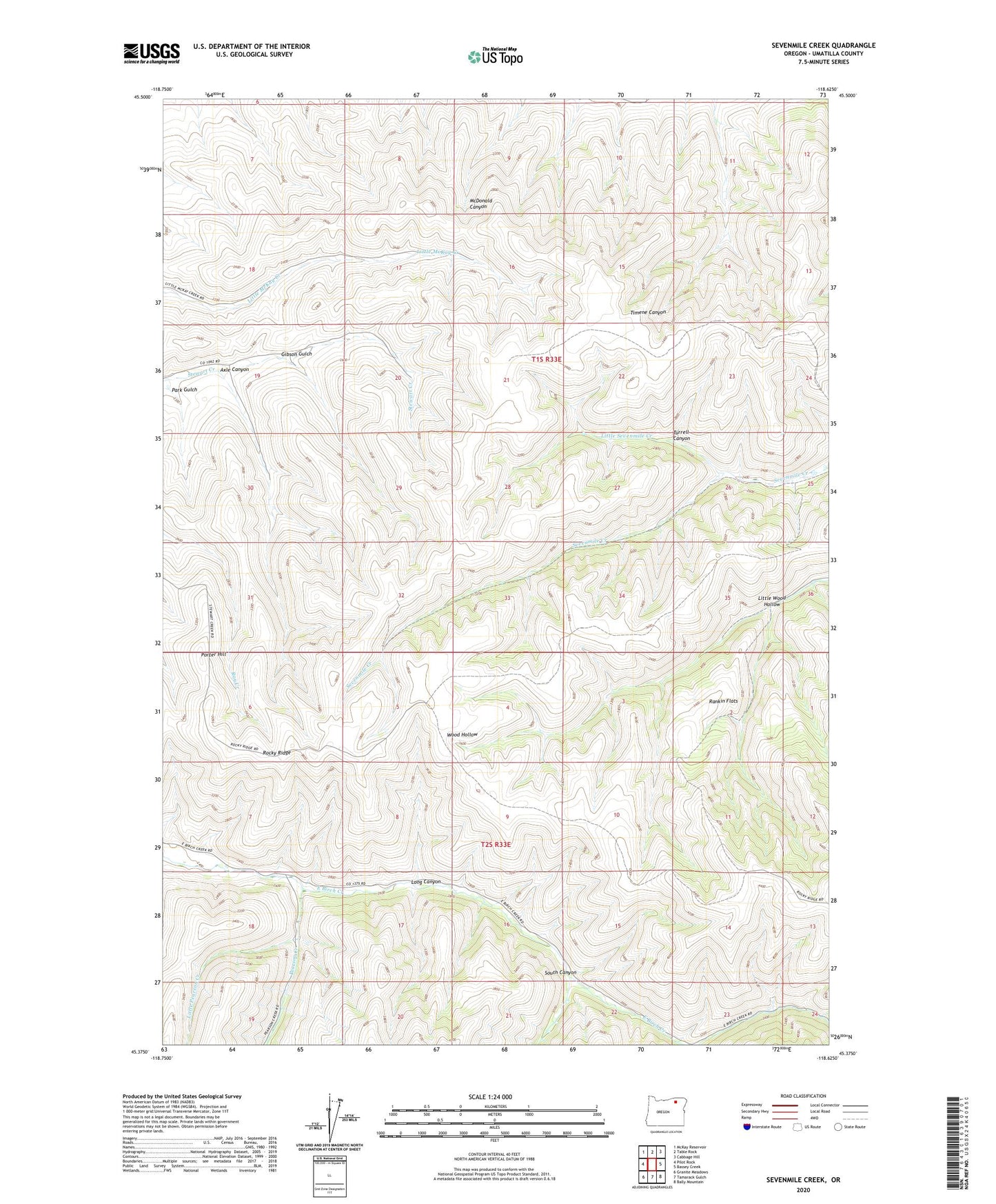
Sevenmile Creek Oregon US Topo Map
Couldn't load pickup availability
Also explore the Sevenmile Creek Forest Service Topo of this same quad for updated USFS data
2023 topographic map quadrangle Sevenmile Creek in the state of Oregon. Scale: 1:24000. Based on the newly updated USGS 7.5' US Topo map series, this map is in the following counties: Umatilla. The map contains contour data, water features, and other items you are used to seeing on USGS maps, but also has updated roads and other features. This is the next generation of topographic maps. Printed on high-quality waterproof paper with UV fade-resistant inks.
Quads adjacent to this one:
West: Pilot Rock
Northwest: McKay Reservoir
North: Table Rock
Northeast: Cabbage Hill
East: Bassey Creek
Southeast: Bally Mountain
South: Tamarack Gulch
Southwest: Granite Meadows
This map covers the same area as the classic USGS quad with code o45118d6.
Contains the following named places: Axle Canyon, Gibson Gulch, Little Pearson Creek, Little Sevenmile Creek, Little Wood Hollow, Long Canyon, McKay Census Designated Place, Park Gulch, Pearson Creek, Porter Hill, Rankin Flats, Rocky Ridge, South Canyon, Turrell Canyon