MyTopo
Bates Oregon US Topo Map
Couldn't load pickup availability
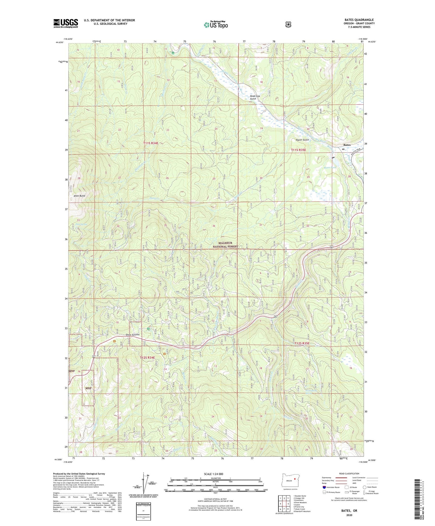
2020 topographic map quadrangle Bates in the state of Oregon. Scale: 1:24000. Based on the newly updated USGS 7.5' US Topo map series, this map is in the following counties: Grant. The map contains contour data, water features, and other items you are used to seeing on USGS maps, but also has updated roads and other features. This is the next generation of topographic maps. Printed on high-quality waterproof paper with UV fade-resistant inks.
Quads adjacent to this one:
West: Dixie Meadows
Northwest: Boulder Butte
North: Vinegar Hill
Northeast: Greenhorn
East: Austin
Southeast: Deardorff Mountain
South: Isham Creek
Southwest: Prairie City
Contains the following named places: Austin Junction, Bates, Bates Dam, Bates Pond, Bates Post Office, Bridge Creek, Bridge Creek Meadow, Caribou Creek, Clear Creek, Davis Creek, Davis Creek Trail, Dead Cow Gulch, Deerhorn Campground, Deerhorn Creek, Dixie, Dixie Recreation Site, Dixie Ski Bowl Recreation Site, Dixie Spring, Dixie Summit, Dixie Trail Mine, Easy Creek, Huckleberry Spring, Lunch Creek, North Fork Bridge Creek, Placer Gulch, Prairie City Division, Reynolds Creek Trail, Vincent Creek, Vinegar Creek