MyTopo
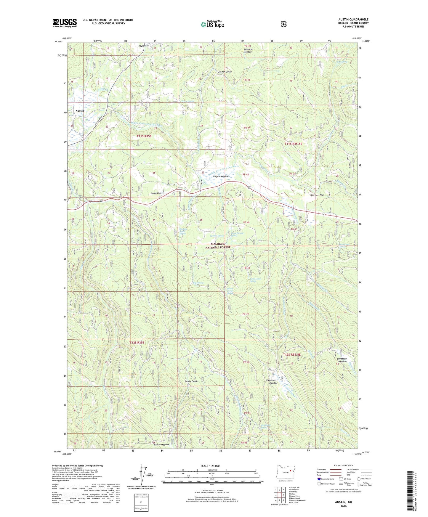
Austin Oregon US Topo Map
Couldn't load pickup availability
Also explore the Austin Forest Service Topo of this same quad for updated USFS data
2023 topographic map quadrangle Austin in the state of Oregon. Scale: 1:24000. Based on the newly updated USGS 7.5' US Topo map series, this map is in the following counties: Grant. The map contains contour data, water features, and other items you are used to seeing on USGS maps, but also has updated roads and other features. This is the next generation of topographic maps. Printed on high-quality waterproof paper with UV fade-resistant inks.
Quads adjacent to this one:
West: Bates
Northwest: Vinegar Hill
North: Greenhorn
Northeast: Whitney
East: Pogue Point
Southeast: Rail Gulch
South: Deardorff Mountain
Southwest: Isham Creek
This map covers the same area as the classic USGS quad with code o44118e4.
Contains the following named places: Austin, Austin Post Office, Big Springs, Bjerkson Flat, Blue Mountain Work Center, Camp Flat, Camp Noxage Spring, Crawford Creek, Dry Fork Clear Creek, Fisks Post Office, Fly Creek, Frosty Gulch, Frosty Meadow, Idaho Creek, Japanese Meadow, Little Phipps Creek, Mill Creek, Newtons, Olmstead Creek, Olmstead Meadow, Papoose Creek, Penola Post Office, Phipps Creek, Phipps Meadow, Quaking Aspen Spring, Rock Creek Spring, Rock Spring, Savage Creek, Section Corner Spring, Sheep Creek, Sixteen Gulch, Steamboat Spring, Sullens Cow Camp, Summit Creek, Summit Spring, Twin Ponds, Wiwaanaytt Creek, Wiwaanaytt Meadow, Wood Camp Spring