MyTopo
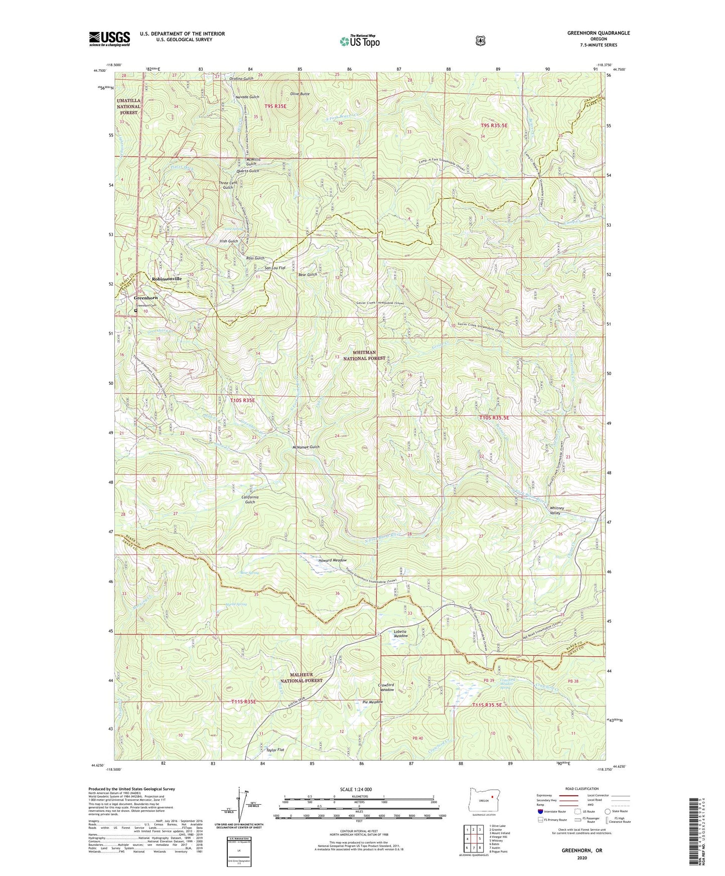
Greenhorn Oregon US Topo Map
Couldn't load pickup availability
Also explore the Greenhorn Forest Service Topo of this same quad for updated USFS data
2024 topographic map quadrangle Greenhorn in the state of Oregon. Scale: 1:24000. Based on the newly updated USGS 7.5' US Topo map series, this map is in the following counties: Baker, Grant. The map contains contour data, water features, and other items you are used to seeing on USGS maps, but also has updated roads and other features. This is the next generation of topographic maps. Printed on high-quality waterproof paper with UV fade-resistant inks.
Quads adjacent to this one:
West: Vinegar Hill
Northwest: Olive Lake
North: Granite
Northeast: Mount Ireland
East: Whitney
Southeast: Pogue Point
South: Austin
Southwest: Bates
This map covers the same area as the classic USGS quad with code o44118f4.
Contains the following named places: Aurora Mine, Bear Gulch, Bear Spring, Belcher Mine, Bennett Creek, Big Elk Mine, Bonanza Mine, California Gulch, China Creek, City of Greenhorn, Corral Camp, Crawford Meadow, Crawford Meadow Spring, Cub Creek, Dawson Mine, Diamond Jack Mine, Diffin Post Office, Don Juan Mine, Eureka Mine, Geiser, Geiser Creek, Geiser Post Office, Golden Boy Mine, Golden Eagle Mine, Golden Gate Mine, Greenhorn, Greenhorn Cemetery, Greenhorn Creek, Greenhorn Post Office, Howard Meadow, Humboldt Mine, Irish Gulch, IXL Mine, Liston Lake Mine, Lobelia Meadow, McNamee Gulch, McWillis Gulch, Morning Glory Mine, Myrtle Spring, Nevada Gulch, Olive Butte, Ophir Mine, Orofino Gulch, Orofino Mine, Owl Mine, Parkersville, Parkersville Post Office, Parkerville Mine, Phoenix Mine, Pie Meadow, Pix Post Office, Placer Ditch, PYX Mine, Quartz Gulch, Rabbit Mine, Red Bird Mine, Robinsonville, Robinsonville Post Office, Ross Gulch, Royal White Mine, San Lou Flat, Simpson Creek, Slab Creek, Snow Creek, Taylor Flat, Three Cent Gulch, Tipton, Tipton Post Office, Tone Spring, White Pine, White Pine Post Office, Winterville Creek, ZIP Code: 97877