MyTopo
Battle Ax Oregon US Topo Map
Couldn't load pickup availability
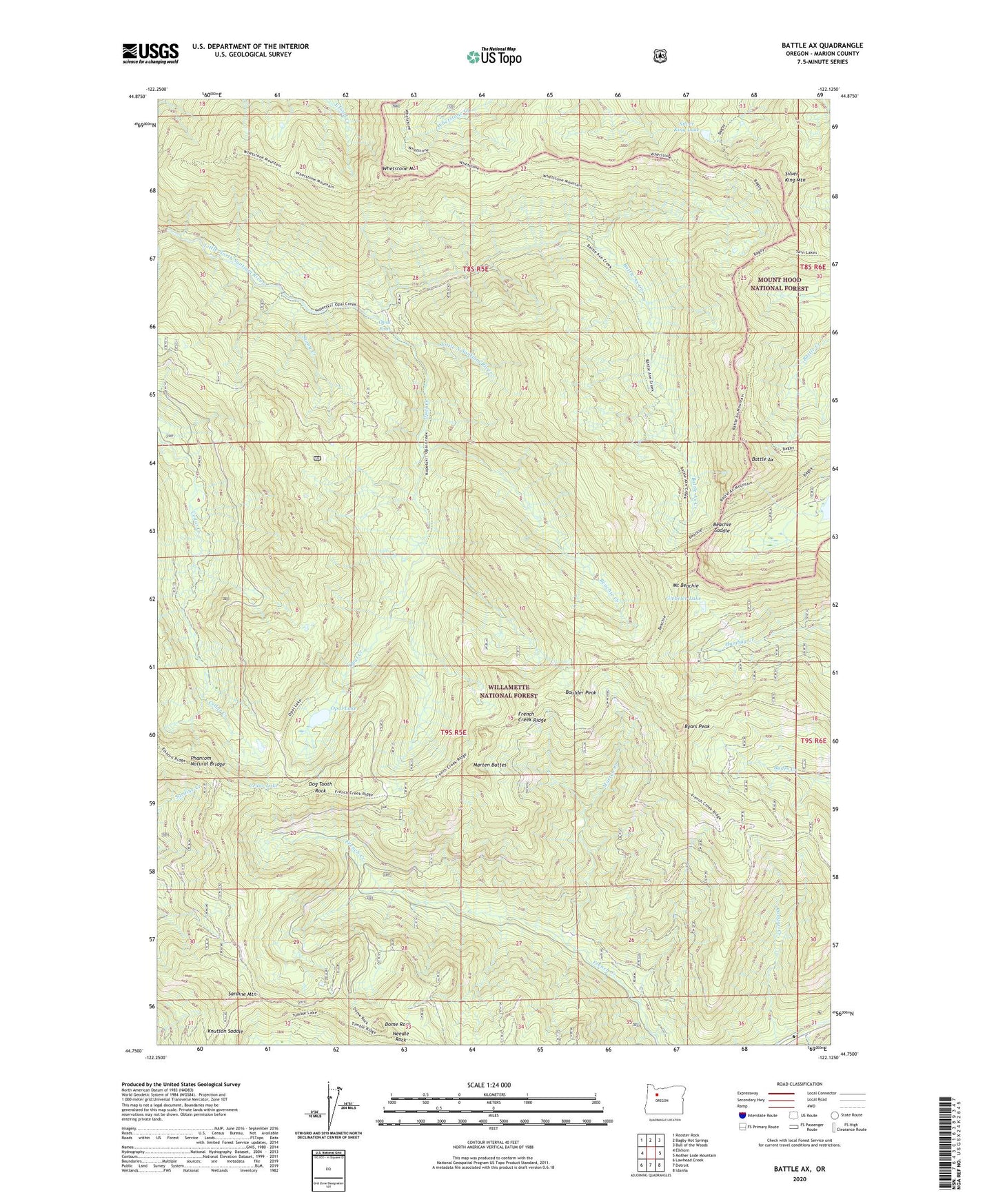
2020 topographic map quadrangle Battle Ax in the state of Oregon. Scale: 1:24000. Based on the newly updated USGS 7.5' US Topo map series, this map is in the following counties: Marion. The map contains contour data, water features, and other items you are used to seeing on USGS maps, but also has updated roads and other features. This is the next generation of topographic maps. Printed on high-quality waterproof paper with UV fade-resistant inks.
Quads adjacent to this one:
West: Elkhorn
Northwest: Rooster Rock
North: Bagby Hot Springs
Northeast: Bull of the Woods
East: Mother Lode Mountain
Southeast: Idanha
South: Detroit
Southwest: Lawhead Creek
Contains the following named places: Amalgamated Mine, Battle Ax, Battle Ax Creek, Beachie Creek, Beachie Saddle, Beachie Trail, Blue Jay Creek, Blue Jay Mine, Boulder Peak, Byars Peak, Cedar Lake, Dog Tooth Rock, Dome Rock, Elk Lake Recreation Site, French Creek Ridge, French Creek Trail, Giebeler Lake, Jawbone Flats, Knutson Saddle, Marten Buttes, Marten Creek, Mount Beachie, Needle Rock, Opal Creek, Opal Creek Trail, Opal Lake, Opal Pool, Phantom Natural Bridge, Rocky Top Shelter, Rocky Top Trail, Sardine Mountain, Silver King Lake, Silver King Mountain, Stony Creek, United States Forest Service Elk Lake Campground Boat Ramp, Whetstone Mountain